Northwest Ohio
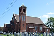
Area in OhioNorthwest Ohio, or Northwestern Ohio, consists of multiple counties in the northwestern corner of the US state of Ohio. This area borders Lake Erie, Southeast Michigan, and northeastern Indiana. Some areas are also considered the Black Swamp area. The Toledo metropolitan area is part of the region.
Read article
Top Questions
AI generatedMore questions
Nearby Places

Ottawa, Ohio
Village in Ohio, US

Great Black Swamp
Wetland in Ohio and Indiana, United States
Ottawa – Glandorf Local School District
School district in Ohio

Ottawa Township, Putnam County, Ohio
Township in Ohio, United States

Dr. H. Huber Block
United States historic place

Ottawa Waterworks Building
United States historic place

Putnam County Courthouse (Ohio)
Local government building in the United States
Riley Creek (Ohio)
Stream in Ohio, United States


