Offa's Dyke Path
Footpath in Wales and EnglandOffa's Dyke Path is a long-distance footpath loosely following the Wales–England border. Officially opened on 10 July 1971, by Lord Hunt, it is one of Britain's National Trails and draws walkers from throughout the world. About 60 miles (97 km) of the 177-mile (285 km) route either follows, or keeps close company with, the remnants of Offa's Dyke, an earthwork traditionally thought to have been constructed in the late 8th century on the orders of King Offa of Mercia.
Read article


Top Questions
AI generatedMore questions
Nearby Places

Offa's Dyke
Ancient earthwork in the United Kingdom
Glyndŵr's Way
Long-distance footpath in Wales
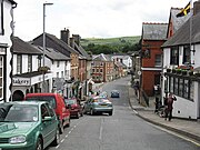
Knighton, Powys
Town on the Wales-England border

Knighton railway station
Railway station in Shropshire, England

Nether Skyborry
Human settlement in England

Knighton Rural District
Rural district in the administrative county of Radnorshire, Wales (1894–1974)

Knighton Community Centre

Knighton Hospital
Hospital in Powys, Wales