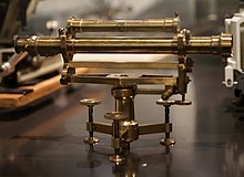
No coordinates found
Level (optical instrument)
Optical instrument to verify horizontal pointsA level is an optical instrument used to establish or verify points in the same horizontal plane in a process known as levelling. It is used in conjunction with a levelling staff to establish the relative height or levels of objects or marks. It is widely used in surveying and construction to measure height differences and to transfer, measure, and set heights of known objects or marks.
Read article
Top Questions
AI generatedMore questions


