Owens Valley
Valley in California, United StatesOwens Valley is an arid valley of the Owens River in eastern California in the United States. It is located to the east of the Sierra Nevada, west of the White Mountains and Inyo Mountains, and is split between the Great Basin Desert and the Mojave Desert. The mountain peaks on its west side reach above 14,000 feet (4,300 m) in elevation, while the floor of the Owens Valley is at about 4,000 feet (1,200 m), making the valley the deepest in the United States. The Sierra Nevada casts the valley in a rain shadow, which makes Owens Valley "the Land of Little Rain". The bed of Owens Lake, now a predominantly dry endorheic alkali flat, sits on the southern end of the valley.
Read article


,"_California,_1936.,_ca._1936_-_NARA_-_519935.jpg)


Top Questions
AI generatedMore questions
Nearby Places
Independence, California
Place in California, United States

Independence Airport
Airport in Independence, California
Bend City, California
Former settlement in California, United States

Mount Whitney Fish Hatchery
Historic site
Fort Independence Indian Community of Paiute Indians
Ethnic group

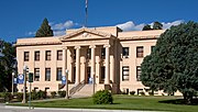
Inyo County Courthouse
United States historic place
Oak Creek (Owens River tributary)
Eastern California Museum
Museum in California