Map Graph

Potomac River

River in the Mid-Atlantic United States

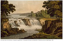
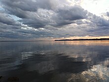
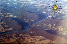
The Potomac River is in the Mid-Atlantic region of the United States and flows from the Potomac Highlands in West Virginia to Chesapeake Bay in Maryland. It is 405 miles (652 km) long, with a drainage area of 14,700 square miles (38,000 km2), and is the fourth-largest river along the East Coast of the United States. More than 6 million people live within its watershed.

Read article
File:Great_Falls_of_the_Potomac_River_-_NPS.jpgFile:AHR-logo.pngFile:Potomacwatershedmap.pngFile:Potomac_River_in_District_of_Columbia_IMG_4720.JPGFile:Physiographic_provinces_of_the_Mid-Atlantic_region_by_NPS.pngFile:North_Branch_Potomac_River_Cumberland.jpgFile:Hanging_Rocks_Wappocomo_WV_1890s.jpgFile:Aerial_Photo_of_Harpers_Ferry_(15646790473).jpgFile:2016-08-28_10_15_51_View_southwest_across_the_Potomac_River_from_the_south_end_of_Cobb_Island_Road_on_Cobb_Island,_Charles_County,_Maryland.jpgFile:Detail_of_1608_Smith_Map_showing_the_Patawomeck_River.jpgFile:Tundra_swans_(6565983429).jpgFile:View_of_the_Potomac_River_-_George_Washington_Birthplace_National_Monument_-_Stierch_-_B.jpgFile:Potomac_River_Tourist_Boat_near_Lincoln_Memorial,_Washington_DC.jpgFile:Conferderate_army_crossing_the_Potomac_River_during_the_invasion_of_Maryland.jpgFile:Defense_of_Washington_-_6_views-_2_views_of_Chain_Bridge,_Pimmitt_Run_Bridge_(small_bridge_near_Chain_Bridge),_Block_House_for_defense_of_Aqueduct_Bridge,_and_Georgetown_Ferry_LCCN2003670507.jpgFile:PR_Chain_Bridge_Lower_Battery_ca_1862_LOC.jpgFile:Georgetown_1861.jpgFile:Map_of_the_Potomac_River_~1862_by_Sneden_LOC.jpgFile:Coast_Guard,_multiple_partner_agencies,_responding_to_plane_crash_in_Potomac_River_(8847923).jpgFile:The_Potomac_River_surges_over_Chain_Bridge_during_1936_Flood_19_March_1936.jpgFile:Potomac_green_water.JPGFile:Potomac_River_Discharge_at_Little_Falls_1931-2017.jpgFile:PR_VA_MD_WV_Boundary_near_Harpers_Ferry_by_USFWS_ebm.pngFile:Potomac_River_passing_through_two_water_gaps.jpgFile:Land_Use_in_the_Potomac_Basin.gifFile:American_Shad_by_Duane_Raver_USFWS.jpgFile:Bottlenose_dolphin_with_young.JPGFile:Eastern_Box_Turtle_NPS.jpgFile:Fivelined_skink.jpgFile:South_Branch_Potomac_River_South_Branch_Depot_WV_2004.JPGFile:View_of_Potomac_River_at_Junction_of_Cacapon_River.jpgFile:Potomac_River_Water_Gaps_Harpers_Ferry_w_compass_and_pointer.jpgFile:Potomac_River_at_Goose_Creek.jpgFile:PR_Great_Falls_of_the_Potomac_aquatint_by_George_Beck_1802.jpgFile:Potomac_River_at_Occonquan_Bay.jpgFile:PR_Georgetown_or_City_of_Washington_1801_by_Beck.jpgFile:Jefferson_Memorial.jpgFile:The_Pentagon_US_Department_of_Defense_building.jpgFile:East_Branch_of_the_Potomac_1839_(via_xparency)_LOC.jpgFile:View_of_Potomac_River_from_Mount_Vernon.jpgFile:Potomac_Reagan_National.jpgFile:2016-06-06_16_55_09_View_northeast_down_the_North_Branch_Potomac_River_from_the_Gorman-Gormania_Bridge_(U.S._Route_50)_between_Gormania,_Grant_County,_West_Virginia_and_Gorman,_Garrett_County,_Maryland.jpgFile:2016-06-18_07_22_42_View_east_down_the_North_Branch_Potomac_River_from_the_Piedmont-Westernport_Bridge_between_Piedmont,_Mineral_County,_West_Virginia_and_Westernport,_Allegany_County,_Maryland.jpgFile:Potomac_River_South_Branch_Depot_WV_2007_05_07_07.jpgFile:South_Branch_Potomac_River_Millesons_Mill_WV_2007_05_07_01.jpgFile:Map_of_Potomac_River_Watershed_in_West_Virginia_Virginia_Pennsylvania_Maryland.jpg
Top Questions
AI generated

List the top facts about Potomac River

Summarize this article

What is the single most intriguing fact about Potomac River?

Are there any controversies surrounding Potomac River?

More questions