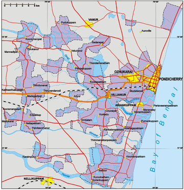
Puducherry district
District of Puducherry in IndiaThe Puducherry District, also known by its former name Pondicherry district, is one of the four districts of the union territory of Puducherry in South India. The district occupies an area of 290 square kilometres (110 sq mi), spread over 12 non-contiguous enclaves lying on or near the Bay of Bengal within a compact area in the state of Tamil Nadu. According to the 2011 census, the district has a population of 950,289.
Read article
Top Questions
AI generatedMore questions
Nearby Places

Puducherry (union territory)
Union territory of India

Pondicherry
City in Puducherry, India

Mudaliarpet Assembly constituency
Constituency of the Puducherry legislative assembly in India

Oupalam Assembly constituency
Constituency of the Puducherry legislative assembly in India
Indira Gandhi Sports Stadium
Sports stadium in Puducherry, India
Christ Institute of Technology
Engineering college in Pondicherry, India
Saradha Gangadharan College
Providence Mall
Shopping mall in Puducherry, India

