Redruth
Town and civil parish in Cornwall, EnglandRedruth is a town and civil parish in Cornwall, England. Redruth lies approximately at the junction of the A393 and A3047 roads, on the route of the old London to Land's End trunk road, and is approximately 9 miles (14 km) west of Truro, 12 miles (19 km) east of St Ives, 18 miles (29 km) north east of Penzance and 11 miles (18 km) north west of Falmouth. At the 2021 census the population of the parish was 15,626 and the population of the built up area was 15,455.
Read article


.jpg)


Top Questions
AI generatedMore questions
Nearby Places

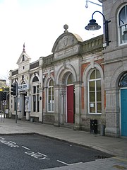
Redruth railway station
Railway station in Cornwall, England
Redruth School
Foundation school in Redruth, Cornwall, England
Mining Exchange
Historical building in the UK

Redruth Grammar School
Plain-an-Gwarry
Human settlement in England

Kresen Kernow
Archive centre in Cornwall, England
Highfields Private School
Private school in Redruth, Cornwall, England

Old Courthouse, Redruth
Municipal building in Redruth, Cornwall, England