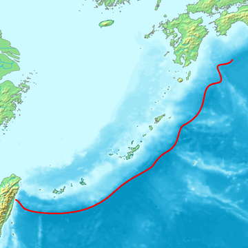
Ryukyu Trench
Oceanic trench along the southeastern edge of Japan's Ryukyu Islands in the Pacific OceanThe Ryukyu Trench , also called Nansei-Shotō Trench, is a 1398 km (868 mi) long oceanic trench located along the southeastern edge of Japan's Ryukyu Islands in the Philippine Sea in the Pacific Ocean, between northeastern Taiwan and southern Japan. The trench has a maximum depth of 7460 m (24,476 ft). The trench is the result of oceanic crust of the Philippine Plate obliquely subducting beneath the continental crust of the Eurasian plate at a rate of approximately 52 mm/yr. In conjunction with the adjacent Nankai Trough to the northeast, subduction of the Philippine plate has produced 34 volcanoes. The largest earthquake to have been recorded along the Ryukyu Trench, the 1968 Hyūga-nada earthquake, was magnitude 7.5 and occurred along the northernmost part of the trench on 1 April 1968. This earthquake also produced a tsunami.

