Map Graph

Samoan Islands

Archipelago in the South Pacific Ocean

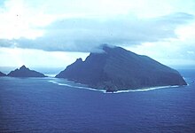
The Samoan Islands are an archipelago covering 3,030 km2 (1,170 sq mi) in the central South Pacific, forming part of Polynesia and of the wider region of Oceania. Administratively, the archipelago comprises all of the Independent State of Samoa and most of American Samoa. The land masses of the two Samoan jurisdictions are separated by 64 km of ocean at their closest points.

Read article
File:Olosega_Aerial_AKK.jpgFile:Samoa_islands_2002.gifFile:German,_British,_American_warships_in_Apia_harbour,_Samoa_1899.jpgFile:Samoa_Country_map.pngFile:US_-American_Samoa.pngFile:A_Manaia,_son_of_a_Samoan_matai_photo_Andrew.Thomas.jpgFile:Hotspot(geology)-1.svgFile:Kermadec_Arc.jpgFile:Volcano_eruption_Mt_Matavanu_-_Savai'i_-_1905_-_photo_by_Thomas_Andrew.jpgFile:Afono_Village_NPS.jpgFile:Aunu'u_Island_National_National_Landmark.jpgFile:1farleftpalms.jpgFile:Fuipisia_waterfall_-_Samoa.jpg
Top Questions
AI generated

List the top facts about Samoan Islands

Summarize this article

What is the single most intriguing fact about Samoan Islands?

Are there any controversies surrounding Samoan Islands?

More questions