San Diego–Tijuana
Transborder agglomeration of the CaliforniasSan Diego–Tijuana is an international transborder agglomeration, straddling the border of the adjacent North American coastal cities of San Diego, California, United States, and Tijuana, Baja California, Mexico. The 2020 population of the region was 5,456,577, making it the largest bi-national conurbation shared between the United States and Mexico, and the second-largest shared between the US and another country. The conurbation consists of San Diego County, in the United States and the municipalities of Tijuana, Rosarito Beach (126,980), and Tecate (108,440) in Mexico. It is the third-most populous region in the California–Baja California region, smaller only than the metropolitan areas of Greater Los Angeles and the San Francisco Bay Area.
Read article
.jpg)

.jpg)

.jpg)


.svg)
.png)


.jpg)
.jpg)

.jpg)


.png)


Top Questions
AI generatedMore questions
Nearby Places

Roman Catholic Archdiocese of Tijuana
Roman Catholic archdiocese in Mexico

San Ysidro Transit Center
San Diego Trolley station

San Ysidro Port of Entry
Border crossing between Mexico and the U.S.
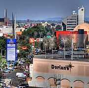
Dorian's

United States Custom House (San Ysidro, California)
United States historic place
Las Americas Premium Outlets
Shopping mall in San Diego, California, United States

Plaza Viva Tijuana
Open-air shopping center in Tijuana, Mexico
Tijuana station
Former passenger rail station and current freight rail station in Tijuana, Mexico