Shortstown
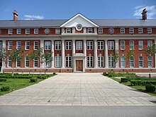
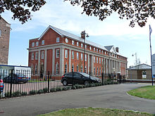
Village and civil parish in Bedfordshire, EnglandShortstown is a village and civil parish on the outskirts of Bedford, on a ridge above the River Great Ouse, originally called Tinkers Hill. The ridge overlooks Harrowden to the north and Cotton End to the south. The village name is taken from Short Brothers. The Admiralty established an airship works for the company in 1916. The company pulled out of airship work just three years later, but the name Shortstown stuck.
Read article
Top Questions
AI generatedMore questions
Nearby Places

Cardington, Bedfordshire
Village and civil parish in England

Eastcotts
Electoral ward in Bedfordshire, England

Harrowden, Bedfordshire
Hamlet in Bedfordshire, England

Kingsbrook, Bedford
Area of Bedford, England

Cotton End
Village in Bedfordshire, England

Cardington Airfield
Former Royal Air Force station in Bedfordshire, England

Cardington railway station
Former railway station in Bedfordshire, England
Cardington Workmen's Platform railway station
Former railway station in Bedfordshire, England


