Stanhope, County Durham
Town in County Durham, EnglandStanhope is a market town and civil parish in the County Durham district, in the ceremonial county of Durham, England. It lies on the River Wear between Eastgate and Frosterley, in the north-east of Weardale. The main A689 road over the Pennines is crossed by the B6278 between Barnard Castle and Shotley Bridge. In 2001 Stanhope had a population of 1,633, in 2019 an estimate of 1,627, and a figure of 1,602 in the 2011 census for the ONS built-up-area which includes Crawleyside. In 2011 the parish population was 4,581.
Read article
.jpg)
.jpg)


Top Questions
AI generatedMore questions
Nearby Places

Crawleyside
Village in County Durham, England

Shittlehope
Hamlet in County Durham, England

Unthank, Stanhope
Human settlement in England
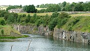
Greenfoot Quarry
Disused quarry in Durham

Heathery Burn Cave
Cave and archaeological site in the United Kingdom
Crawley Edge Cairns
Crawley railway station (Durham)
Short-lived railway station in Crawleyside, County Durham

Stanhope Town Hall
Municipal building in Stanhope, County Durham, England