Swingate transmitting station
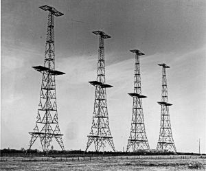
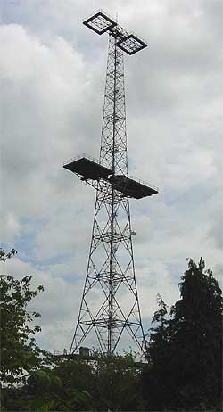
Transmitter station in Kent, EnglandThe Swingate transmitting station is a facility for FM-transmission in the village of Swingate, near Dover, Kent. For many years there were three lattice towers with a height of 111 metres (364 ft). This station was one of the first 5 Chain Home Radar stations completed in 1936 and was originally designated AMES 04 Dover. The FM transmitting antennas are attached to what was the middle tower; microwave link dishes and mobile telephone antennas were spread across all three towers. The south tower was dismantled in March 2010, as a result, only two remain.
Read article
Top Questions
AI generatedMore questions
Nearby Places

Dover Castle
Medieval castle in Dover, Kent, England

Duke of York's Royal Military School
Selective academy in Kent, England

Fort Burgoyne
Swingate, Kent
Village in Kent, England

Langdon Bay (Kent)
Bay in Kent, England

Connaught Barracks, Dover
Military installation in Kent, England
RAF Swingate Down
Former RAF station in Kent, England
Langdon Bay Wreck


