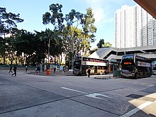
Tai Po District
District in Hong Kong, ChinaTai Po District is one of the 18 districts of Hong Kong. The suburban district covers the areas of Tai Po New Town, Tai Po Tau, Tai Po Kau, Hong Lok Yuen, Ting Kok, Plover Cove, Lam Tsuen Valley, Tai Mei Tuk and other surrounding areas, and its exclaves Sai Kung North, in the northern part of the Sai Kung Peninsula and including islands such as Grass Island, and Ping Chau. Tai Po proper and Sai Kung North are divided by the Tolo Channel and the Tolo Harbour. The district is located in the Eastern New Territories. The de facto administrative centre of the district is Tai Po New Town.
Read article
Top Questions
AI generatedMore questions
Nearby Places

Hong Kong Railway Museum
Railway museum in Tai Po, Hong Kong

Tai Wo station
MTR station in the New Territories, Hong Kong

Tai Po Sports Ground
Sports venue in Hong Kong

Tai Po Government Primary School
Primary school in Hong Kong

Tai Po Mega Mall
Shopping centre in Tai Po, Hong Kong

Tai Yuen Estate
Public housing estate in Tai Po, Hong Kong

Tai Wo Estate
Public housing estate in Tai Po, Hong Kong

Po Heung Estate
Public housing estate in Tai Po, Hong Kong


