Tehachapi, California
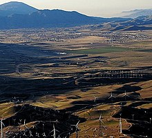
City in California, United StatesTehachapi is a city in Kern County, California, United States, in the Tehachapi Mountains, at an elevation of 3,970 feet (1,210 m), between the San Joaquin Valley and the Mojave Desert. Tehachapi is 35 miles (56 km) east-southeast of Bakersfield, and 20 miles (32 km) west of Mojave. According to the United States Census Bureau, the city has a total area of 10 square miles (26 km2) and a population of 12,939. The Tehachapi area is known for the nearby Tehachapi Loop, the Pacific Crest Trail and for the excellent conditions for the aerial sport of gliding.
Read article
Top Questions
AI generatedMore questions
Nearby Places

Golden Hills, California
Census-designated place in California, United States

Tehachapi Municipal Airport
Airport in Kern County, California, U.S.
Tehachapi High School
Public school in Tehachapi, California

Mountain Valley Airport
Airport

Monroe High School (Tehachapi)
Public school
Tehachapi Unified School District
School district in California

Errea House
Historic house in California, United States

Tehachapi Railroad Depot


