United Nations Plaza (San Francisco)
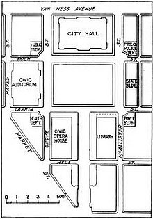
Plaza in San Francisco's Civic CenterUnited Nations Plaza is a 2.6-acre (1.1 ha) plaza located on the former alignments of Fulton and Leavenworth Streets—in the block bounded by Market, Hyde, McAllister, and 7th Street—in the Civic Center of San Francisco, California. It is located 1⁄4 mi (0.40 km) east of City Hall and is connected to it by the Fulton Mall and Civic Center Plaza. Public transit access is provided by the BART and Muni Metro stops at the Civic Center/UN Plaza station, which has a station entrance within the plaza itself.
Read article
Top Questions
AI generatedMore questions
Nearby Places
University of California College of the Law, San Francisco
Public law school in San Francisco, California

Civic Center/UN Plaza station
Rapid transit station in San Francisco, California, US

Orpheum Theatre (San Francisco)
Theatre in San Francisco, California, U.S.

McAllister Tower Apartments
Apartment skyscraper in California

50 United Nations Plaza Federal Office Building (San Francisco)
United States historic place

Mid-Market, San Francisco
Neighborhood in San Francisco, California

Hibernia Bank Building (San Francisco)
American bank located in San Francisco, California

Market Street Cinema


