Wakulla River
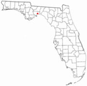
River in Florida, United States of AmericaThe Wakulla River is an 11-mile-long (18 km) river in Wakulla County, Florida. It carries the outflow from Wakulla Springs, site of the Edward Ball Wakulla Springs State Park, to the St. Marks River 3 miles (5 km) north of the Gulf of Mexico. Its drainage basin extends northwest into Leon County, including Munson Slough, and may extend as far north as the Georgia border.
Read article
Top Questions
AI generatedMore questions
Nearby Places

St. Marks, Florida
City in Florida, United States

San Marcos de Apalache Historic State Park
Archaeological site in Florida, United States

Newport, Florida
Place in Florida, United States

George Nesmith Bridge
Bridge in Florida, United States of America

St. Marks National Wildlife Refuge
United States National Wildlife Refuge in Florida

Fort Ward (Florida)

Port Leon, Florida
Former human settlement in Florida, USA

Bo Lynn's Grocery
United States historic place


