Westfield, East Sussex
Village in East Sussex, EnglandWestfield is a village and civil parish in the Rother district of East Sussex. It is one of the largest villages in the area with a population of 2,819. The village lies five miles (8 km) north of Hastings. It was known as Westewelle in the Domesday survey. It is located on the A28 road which runs from Hastings to Ashford and beyond.
Read article

Top Questions
AI generatedMore questions
Nearby Places

Three Oaks railway station
Railway station in East Sussex, England

Doleham railway station
Railway station in East Sussex, England

Ark Helenswood Academy
Academy in St Leonards-on-Sea, East Sussex, England
Baldslow
Suburb of Hastings, East Sussex, England

Maplehurst Wood

Brede Waterworks
Waterworks at Brede, East Sussex, England

Doleham
Hamlet in East Sussex, England
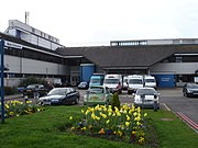
Conquest Hospital
Hospital in England