Wivenhoe Dam
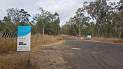
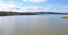
Dam in South East QueenslandWivenhoe Dam is a rock and earth-fill embankment dam with a concrete spillway across the Brisbane River in South East Queensland, Australia. The dam takes it names from the local Wivenhoe Pocket rural community. The dam wall is located about 80 kilometres (50 mi) by road from the centre of Brisbane. The primary purpose of the dam is the supply of potable water for the Brisbane and Ipswich regions. South-east Queensland's largest dam also provides for flood mitigation control, hydroelectricity, and recreation. The impounded reservoir is called Lake Wivenhoe and the dam, the lake and a narrow strip of surrounding land forms a locality also called Lake Wivenhoe.
Read article
Top Questions
AI generatedMore questions
Nearby Places

Wivenhoe Power Station
Dam in Split Yard Creek, Queensland

Lockyer Creek
River in Queensland, Australia

Splityard Creek Dam
Dam in South East Queensland
SEQ Water Grid
Water operator for South East Queensland

Wivenhoe Pocket
Suburb of Somerset Region, Queensland, Australia

Patrick Estate, Queensland
Suburb of Somerset Region, Queensland, Australia

Wivenhoe Hill, Queensland
Suburb of Somerset Region, Queensland, Australia

Leyburn Airfield


