File:Europe_countries_map_it_2.png
From Wikipedia, the free encyclopedia
Aurreikuspen honen neurria: 737 × 600 pixel. Bestelako bereizmenak: 295 × 240 pixel | 590 × 480 pixel | 944 × 768 pixel | 1.259 × 1.024 pixel | 1.475 × 1.200 pixel.
Bereizmen handikoa ((1.475 × 1.200 pixel, fitxategiaren tamaina: 833 KB, MIME mota: image/png))
Fitxategi hau Wikimedia Commonsekoa da. Hango deskribapen orriko informazioa behean duzu. |
Laburpena
| DeskribapenaEurope countries map it 2.png |
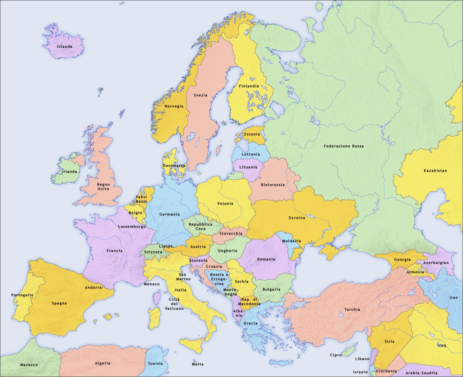
English: Map of countries in Europe and the surrounding region |
||||||||||
| Data | 02.04.2006 | ||||||||||
| Jatorria | derivative work of Europe countries map it.png by San Jose, based on the Generic Mapping Tools and ETOPO2 | ||||||||||
| Egilea | San Jose (map), Hayden120 (retouch) | ||||||||||
| Lizentzia (Fitxategi hau berrerabiltzen) |
|
||||||||||
| Beste bertsioak |
[aldatu]
|


| This is a retouched picture, which means that it has been digitally altered from its original version. Modifications: Saturation, brightness, contrast. The original can be viewed here: Europe countries map it.png:
|
See also
_en.png)
.png)
.jpg)
Irudi-oineko testuak
Add a one-line explanation of what this file represents
Fitxategi honetan agertzen diren itemak
honako hau irudikatzen du
Fitxategiaren historia
Data/orduan klik egin fitxategiak orduan zuen itxura ikusteko.
| Data/Ordua | Iruditxoa | Neurriak | Erabiltzailea | Iruzkina | |
|---|---|---|---|---|---|
| oraingoa | 10:09, 11 iraila 2009 | | 1.475 × 1.200 (833 KB) | Hayden120 | == {{int:filedesc}} == {{Information |Description= {{en|Map of countries in Europe}} |Source=derivative work of Europe countries map it.png by San Jose, based on the [http://gmt.soest.hawaii.edu/ Gen |
Irudira dakarten loturak
Ez dago fitxategi hau darabilen orririk.
"https://eu.wikipedia.org/wiki/Fitxategi:Europe_countries_map_it_2.png"(e)tik eskuratuta