Fichier:2004_Pacific_hurricane_season_summary_map.png
De Wikipedia, l'encyclopédie encyclopedia
Taille de cet aperçu : 800 × 494 pixels. Autres résolutions : 320 × 198 pixels | 640 × 396 pixels | 1 024 × 633 pixels | 1 280 × 791 pixels | 2 560 × 1 582 pixels | 4 000 × 2 472 pixels.
Fichier d’origine (4 000 × 2 472 pixels, taille du fichier : 5,11 Mio, type MIME : image/png)
Ce fichier et sa description proviennent de Wikimedia Commons.
Description
| Description2004 Pacific hurricane season summary map.png |
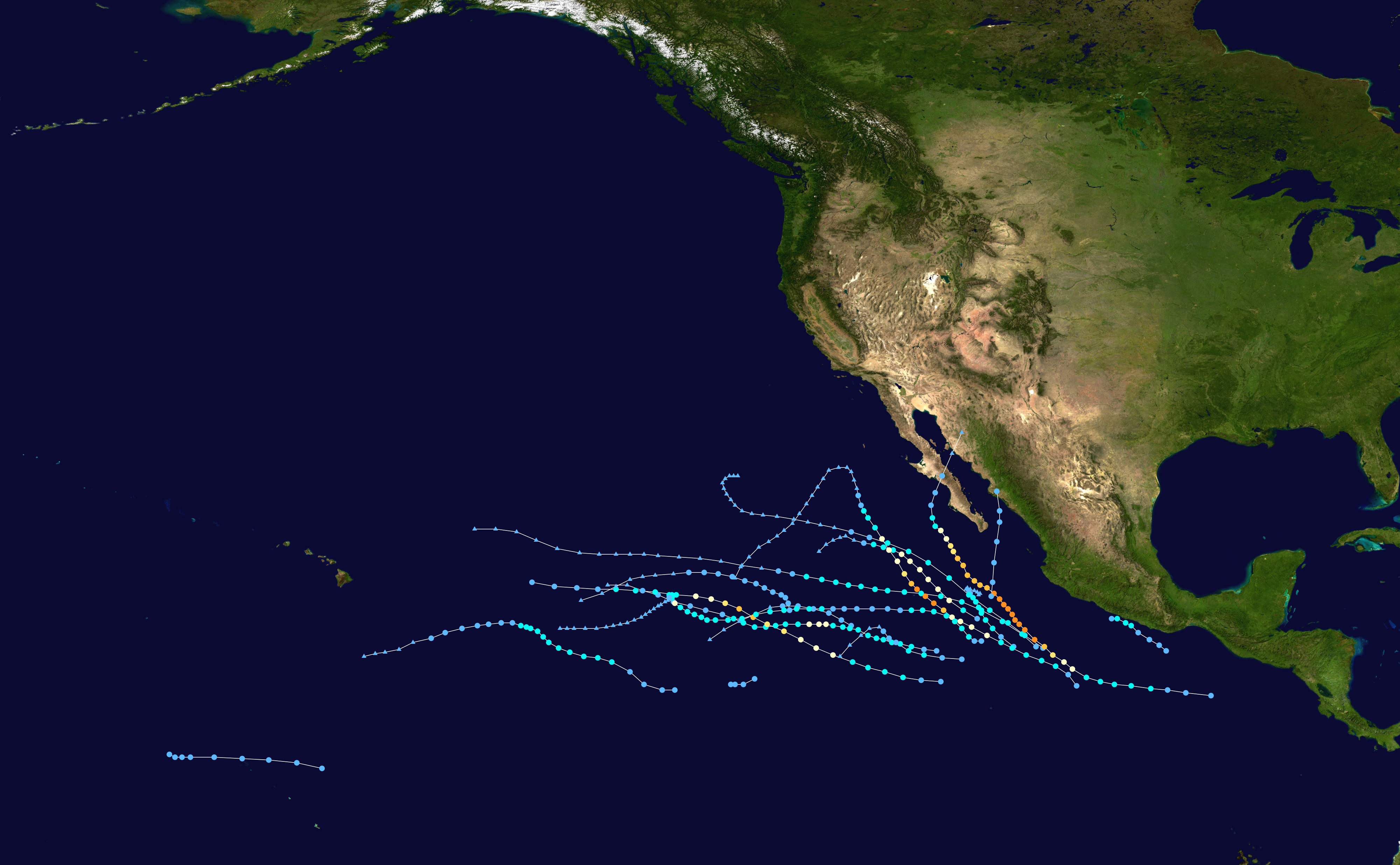
English: This map shows the tracks of all tropical cyclones in the 2004 Pacific hurricane season. The points show the location of each storm at 6-hour intervals. The colour represents the storm's maximum sustained wind speeds as classified in the Saffir-Simpson Hurricane Scale (see below), and the shape of the data points represent the type of the storm.
Storm type |
| Date |
|
| Source | Created using Wikipedia:WikiProject Tropical cyclones/Tracks. The background image is from NASA [1]. The tracking data is from the National Hurricane Center and the Central Pacific Hurricane Center's Northeast and North Central Pacific hurricane database |
| Auteur | Es204L |
| Public domainPublic domainfalsefalse |
| Cette œuvre a été placée dans le domaine public par son auteur, Es204L. Ceci s’applique dans le monde entier. Dans certains pays, ceci peut ne pas être possible ; dans ce cas : Es204L accorde à toute personne le droit d’utiliser cette œuvre dans n’importe quel but, sans aucune condition, sauf celles requises par la loi. |
Légendes
Ajoutez en une ligne la description de ce que représente ce fichier
Éléments décrits dans ce fichier
dépeint
Valeur sans élément de Wikidata
16 janvier 2016
image/png
1a852da3760dc800655a3b804c1021c25474ae71
5 362 560 octet
2 472 pixel
4 000 pixel
Historique du fichier
Cliquer sur une date et heure pour voir le fichier tel qu'il était à ce moment-là.
| Date et heure | Vignette | Dimensions | Utilisateur | Commentaire | |
|---|---|---|---|---|---|
| actuel | 29 octobre 2020 à 04:01 | | 4 000 × 2 472 (5,11 Mio) | Supportstorm | Added missing systems |
| 9 mai 2019 à 01:30 |  | 3 000 × 1 854 (4,51 Mio) | Es204L | User created page with UploadWizard |
Utilisation du fichier
La page suivante utilise ce fichier :
Usage global du fichier
Les autres wikis suivants utilisent ce fichier :
- Utilisation sur de.wikipedia.org
- Utilisation sur en.wikipedia.org
- Utilisation sur es.wikipedia.org
- Utilisation sur pt.wikipedia.org
- Utilisation sur simple.wikipedia.org
- Utilisation sur www.wikidata.org
- Utilisation sur zh.wikipedia.org
Ce document provient de « https://fr.wikipedia.org/wiki/Fichier:2004_Pacific_hurricane_season_summary_map.png ».