Fichier:Arlene_2005_track.png
De Wikipedia, l'encyclopédie encyclopedia
Taille de cet aperçu : 712 × 600 pixels. Autres résolutions : 285 × 240 pixels | 570 × 480 pixels | 912 × 768 pixels | 1 216 × 1 024 pixels | 2 432 × 2 048 pixels | 2 700 × 2 274 pixels.
Fichier d’origine (2 700 × 2 274 pixels, taille du fichier : 5,84 Mio, type MIME : image/png)
Ce fichier et sa description proviennent de Wikimedia Commons.
Description
| DescriptionArlene 2005 track.png |
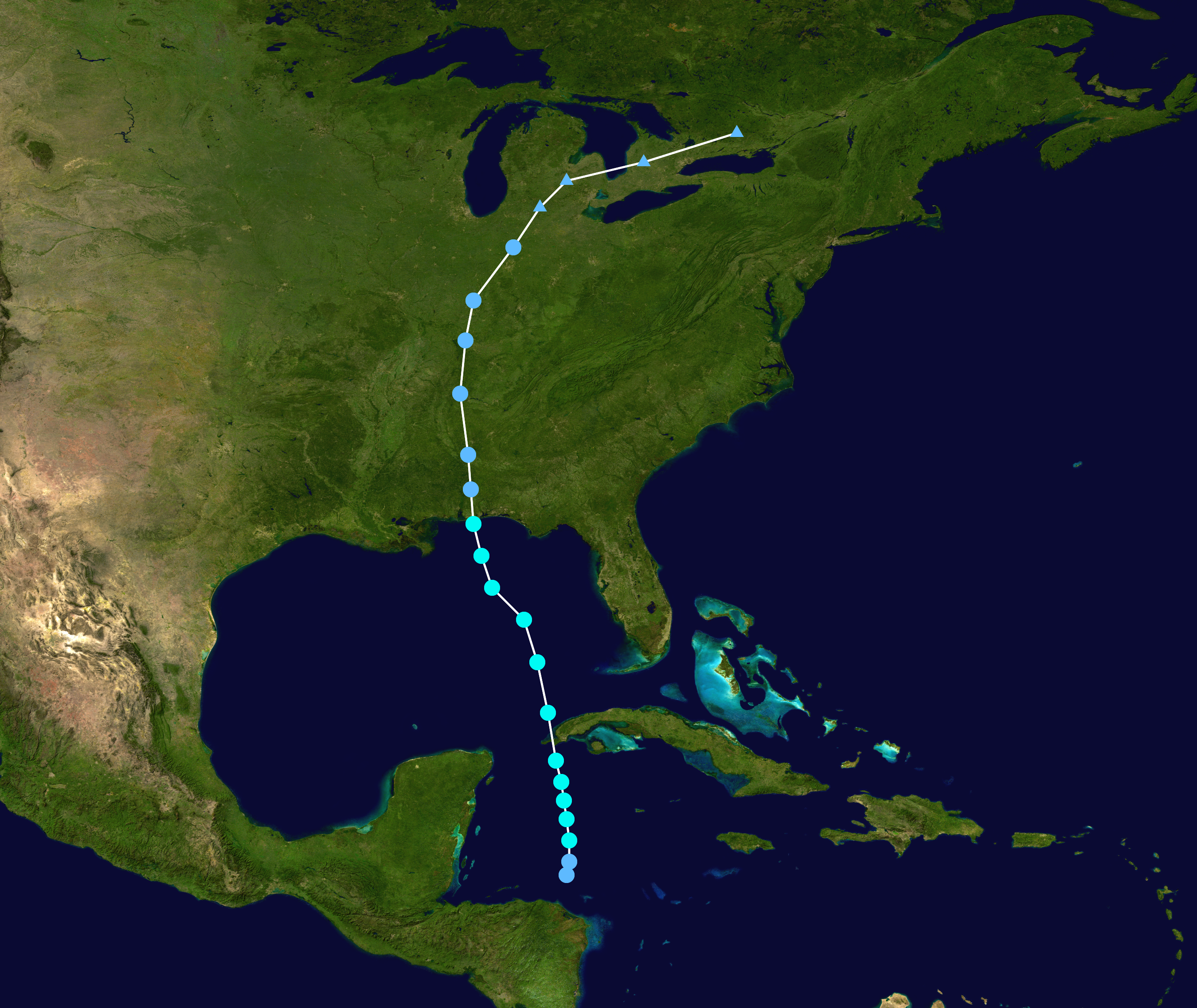
English: Track map of Tropical Storm Arlene of the 2005 Atlantic hurricane season. The points show the location of the storm at 6-hour intervals. The colour represents the storm's maximum sustained wind speeds as classified in the (see below), and the shape of the data points represent the nature of the storm, according to the legend below. Storm type |
||
| Date | 2005-06-08–2005-06-14 | ||
| Source | Created by Supportstorm using Wikipedia:WikiProject Tropical cyclones/Tracks. The background image is from NASA. Tracking data is from the National Hurricane Center[1]. | ||
| Auteur | Supportstorm | ||
| Source code InfoField | Track map data table, if present below, is in HURDAT2 or ATCF format. See format details in [2] and [3], respectively.
|
Conditions d’utilisation
| Public domainPublic domainfalsefalse |
| Cette œuvre a été placée dans le domaine public par son auteur, Supportstorm. Ceci s’applique dans le monde entier. Dans certains pays, ceci peut ne pas être possible ; dans ce cas : Supportstorm accorde à toute personne le droit d’utiliser cette œuvre dans n’importe quel but, sans aucune condition, sauf celles requises par la loi. |
Légendes
Ajoutez en une ligne la description de ce que représente ce fichier
Éléments décrits dans ce fichier
dépeint
image/png
a69877cea32abc52ffa83d484d5396a438065faf
6 127 870 octet
2 274 pixel
2 700 pixel
Historique du fichier
Cliquer sur une date et heure pour voir le fichier tel qu'il était à ce moment-là.
| Date et heure | Vignette | Dimensions | Utilisateur | Commentaire | |
|---|---|---|---|---|---|
| actuel | 7 juin 2013 à 03:23 | | 2 700 × 2 274 (5,84 Mio) | Supportstorm | Full track |
| 13 juillet 2006 à 00:59 |  | 1 024 × 765 (803 kio) | Nilfanion | ||
| 10 juillet 2006 à 20:48 |  | 1 024 × 765 (803 kio) | Nilfanion | {{Hurricane auto track map|Tropical Storm Arlene (2005)}} | |
| 24 janvier 2006 à 22:26 |  | 1 024 × 765 (803 kio) | Jdorje~commonswiki | {{Hurricane auto track map|Tropical Storm Arlene (2005)}} | |
| 14 novembre 2005 à 06:44 |  | 1 024 × 633 (555 kio) | Jdorje~commonswiki | {{Hurricane auto track map|Tropical Storm Arlene (2005)}} | |
| 11 novembre 2005 à 09:05 |  | 1 024 × 633 (555 kio) | Jdorje~commonswiki | ||
| 5 novembre 2005 à 07:20 |  | 633 × 1 024 (515 kio) | Jdorje~commonswiki | {{Hurricane auto track map|Tropical Storm Arlene (2005)}} Arlene Arlene Arlene |
Utilisation du fichier
La page suivante utilise ce fichier :
Usage global du fichier
Les autres wikis suivants utilisent ce fichier :
- Utilisation sur da.wikipedia.org
- Utilisation sur de.wikipedia.org
- Utilisation sur en.wikipedia.org
- Utilisation sur es.wikipedia.org
- Utilisation sur hu.wikipedia.org
- Utilisation sur pt.wikipedia.org
- Utilisation sur simple.wikipedia.org
- Utilisation sur sv.wikipedia.org
- Utilisation sur www.wikidata.org
- Utilisation sur zh.wikipedia.org
Ce document provient de « https://fr.wikipedia.org/wiki/Fichier:Arlene_2005_track.png ».