Fichier:Ocracoke_inlet_north_carolina_1775.jpg
De Wikipedia, l'encyclopédie encyclopedia
Taille de cet aperçu : 635 × 600 pixels. Autres résolutions : 254 × 240 pixels | 508 × 480 pixels | 813 × 768 pixels | 1 025 × 968 pixels.
Fichier d’origine (1 025 × 968 pixels, taille du fichier : 333 kio, type MIME : image/jpeg)
Ce fichier et sa description proviennent de Wikimedia Commons.
Description
| DescriptionOcracoke inlet north carolina 1775.jpg |
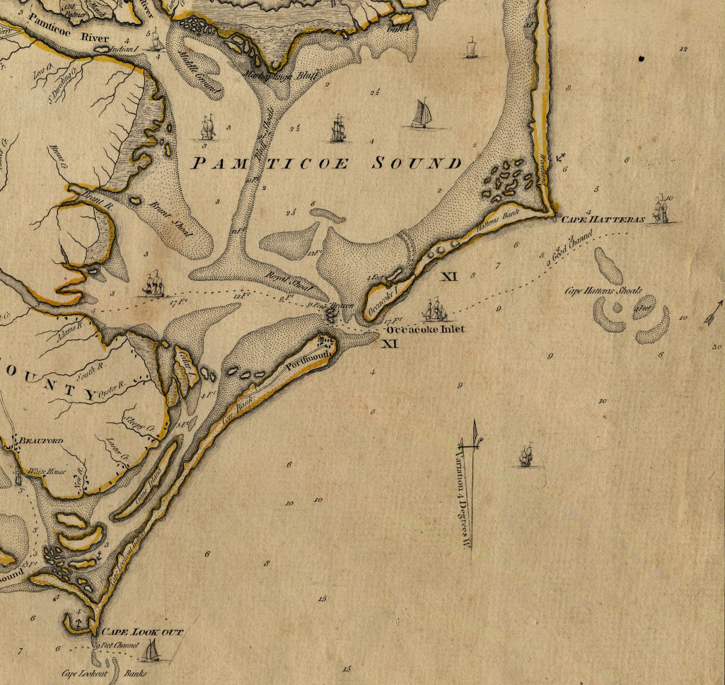
English: An Accurate Map of North and South Carolina With Their Indian Frontiers, Shewing in a distinct manner all the Mountains, Rivers, Swamps, Marshes, Bays, Creeks, Harbours, Sandbanks and Soundings on the Coasts; with The Roads and Indian Paths; as well as The Boundary or Provincial Lines, The Several Townships and other divisions of the Land in Both the Provinces; the whole from Actual Surveys By Henry Mouzon and Others. |
| Date | |
| Source | http://ncrec.dcr.state.nc.us/Cat/CatServer.ASP?WCI=MainEP&WCE=ViewMap&WCU=3.3.1.1.258;i |
| Auteur | from Actual Surveys By Henry Mouzon and Others. |
Conditions d’utilisation
| Public domainPublic domainfalsefalse |
Ce document est dans le domaine public aux États-Unis. Ceci s'applique aux travaux des États-Unis où le copyright a expiré, souvent parce que sa première publication s'est produite avant le 1er janvier 1929. Voir cette page pour davantage d'explication.
|
 | |
 |
Cette image peut ne pas être dans le domaine public en dehors des États-Unis (ceci s'applique particulièrement au Canada, en Chine (pas Hong Kong, Macao, ni Taïwan), en Allemagne ou en Suisse). Le créateur et l'année de la publication sont l'information essentielle et doivent être fournis.
|
Historique du fichier
Cliquer sur une date et heure pour voir le fichier tel qu'il était à ce moment-là.
| Date et heure | Vignette | Dimensions | Utilisateur | Commentaire | |
|---|---|---|---|---|---|
| actuel | 6 février 2010 à 23:45 | | 1 025 × 968 (333 kio) | Parrot of Doom | {{Information |Description={{en|1=An Accurate Map of North and South Carolina With Their Indian Frontiers, Shewing in a distinct manner all the Mountains, Rivers, Swamps, Marshes, Bays, Creeks, Harbours, Sandbanks and Soundings on the Coasts; with The Roa |
Utilisation du fichier
Les 2 pages suivantes utilisent ce fichier :
Usage global du fichier
Les autres wikis suivants utilisent ce fichier :
- Utilisation sur az.wikipedia.org
- Utilisation sur ca.wikipedia.org
- Utilisation sur en.wikipedia.org
- Utilisation sur gl.wikipedia.org
- Utilisation sur hu.wikipedia.org
- Utilisation sur ja.wikipedia.org
- Utilisation sur pt.wikipedia.org
- Utilisation sur ru.wikipedia.org
Métadonnées
Ce fichier contient des informations supplémentaires, probablement ajoutées par l'appareil photo numérique ou le numériseur utilisé pour le créer.
Si le fichier a été modifié depuis son état original, certains détails peuvent ne pas refléter entièrement l'image modifiée.
| Orientation | Normale |
|---|---|
| Résolution horizontale | 100 pt/po |
| Résolution verticale | 100 pt/po |
| Logiciel utilisé | Adobe Photoshop CS3 Windows |
| Date de modification du fichier | 6 février 2010 à 21:43 |
| Espace colorimétrique | Non calibré |
Ce document provient de « https://fr.wikipedia.org/wiki/Fichier:Ocracoke_inlet_north_carolina_1775.jpg ».