Coadan:Occitania_blanck_map.PNG
From Wikipedia, the free encyclopedia
Cha nel jeeskeaylley ny smoo ry-gheddyn.
Occitania_blanck_map.PNG (573 × 397 pixelyn, mooadys y choadan: 10 KB, sorçh MIME: image/png)
This file is from Wikimedia Commons and may be used by other projects. The description on its file description page there is shown below.
| Datasource (reference to visualized facts) is not provided for the data that is visualized in this self-made work. |

|
This linguistic map image could be re-created using vector graphics as an SVG file. This has several advantages; see Commons:Media for cleanup for more information. If an SVG form of this image is available, please upload it and afterwards replace this template with
{{vector version available|new image name}}.
It is recommended to name the SVG file “Occitania blanck map.svg”—then the template Vector version available (or Vva) does not need the new image name parameter. |
Giare-choontey
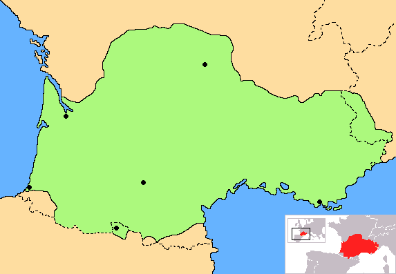
| CoonteyOccitania blanck map.PNG | Correct map of Occitania, with geographic context and remarking of the country borders |
| Date | |
| Bun | Own work |
| Author | Norrin strange |
| Other versions | Derivative works of this file: Occitania aranes map.png |
I, the copyright holder of this work, hereby publish it under the following licenses:

|
Permission is granted to copy, distribute and/or modify this document under the terms of the GNU Free Documentation License, Version 1.2 or any later version published by the Free Software Foundation; with no Invariant Sections, no Front-Cover Texts, and no Back-Cover Texts. A copy of the license is included in the section entitled GNU Free Documentation License.http://www.gnu.org/copyleft/fdl.htmlGFDLGNU Free Documentation Licensetruetrue |
| This file is licensed under the Creative Commons Attribution-Share Alike 3.0 Unported license. | ||
| ||
| This licensing tag was added to this file as part of the GFDL licensing update.http://creativecommons.org/licenses/by-sa/3.0/CC BY-SA 3.0Creative Commons Attribution-Share Alike 3.0truetrue |
You may select the license of your choice.
Captions
Add a one-line explanation of what this file represents
Map of Occitania
Актуальная карта Аксітаніі, з геаграфічным кантэкстам і дакладнымі абазначэннямі межаў краіны
Items portrayed in this file
depicts English
creator English
some value
copyright status English
copyrighted English
source of file English
original creation by uploader English
14 Jerrey Souree 2007
Shennaghys y choadan
Crig er daayt/am ennagh son fakin er y choadan myr v’eh ec y traa shen.
| Daayt/Am | Ingin-ordaag | Towshanyn | Ymmydeyr | Cohaggloo | |
|---|---|---|---|---|---|
| bio | 18:30, 27 Mean Souree 2023 | | 573 × 397 (10 KB) | Jfblanc | Improved boundaries |
| 22:10, 4 Mean Fouyir 2020 |  | 573 × 397 (4 KB) | TSamuel | Minimized colors to 7 to recompress further | |
| 22:08, 4 Mean Fouyir 2020 |  | 573 × 397 (5 KB) | TSamuel | Losslessly recompressed | |
| 16:32, 17 Toshiaght Arree 2009 |  | 573 × 397 (12 KB) | Tripallokavipasek | ||
| 15:21, 14 Jerrey Souree 2007 |  | 573 × 397 (11 KB) | Norrin strange | {{Information |Description=Correct map of Occitania |Source=self-made |Date=14-07-07 |Author= Norrin strange }} {{GFDL-Self}} |
Ymmyd y choadan
Ta ny 1 duillag eiyrtyssagh kianglt rish y choadan shoh:
Global file usage
The following other wikis use this file:
- Usage on ace.wikipedia.org
- Usage on ady.wikipedia.org
- Usage on am.wikipedia.org
- Usage on an.wikipedia.org
- Usage on ar.wikipedia.org
- Usage on be.wikipedia.org
- Usage on br.wikipedia.org
- Usage on ca.wikipedia.org
- Usage on ce.wikipedia.org
- Usage on ckb.wikipedia.org
- Usage on cs.wikipedia.org
- Usage on cv.wikipedia.org
- Usage on cy.wikipedia.org
- Usage on da.wikipedia.org
- Usage on diq.wikipedia.org
- Usage on en.wiktionary.org
- Usage on eo.wikipedia.org
- Usage on eo.wikinews.org
- Usage on es.wikipedia.org
- Usage on et.wikipedia.org
- Usage on eu.wikipedia.org
- Usage on fa.wikipedia.org
- Usage on fi.wikipedia.org
- Usage on fr.wikipedia.org
- Usage on fr.wiktionary.org
- Usage on fur.wikipedia.org
- Usage on gd.wikipedia.org
- Usage on gl.wikipedia.org
- Usage on hr.wikipedia.org
- Usage on hr.wiktionary.org
- Usage on hsb.wikipedia.org
- Usage on hu.wikipedia.org
- Usage on hy.wikipedia.org
- Usage on id.wikipedia.org
- Usage on ilo.wikipedia.org
- Usage on io.wikipedia.org
- Usage on is.wikipedia.org
View more global usage of this file.
Metadata
Ta'n coadan shoh goaill tooilley fysseree stiagh, currit veih'n çhamraig vun-earrooagh ny yn scanreyder, as eh ymmydit dys y coadan y chroo ny y yannoo bun-earrooagh, s'liklee.
My vel y coadan ceaghlit veih'n chummey bunneydagh, foddee nagh beagh mynphoyntyn ennagh cohoilshaghey yn coadan ceaghlit.
| Horizontal resolution | 28.34 dpc |
|---|---|
| Vertical resolution | 28.34 dpc |