トップQs
タイムライン
チャット
視点
世界の山一覧 (高さ順)
ウィキメディアの一覧記事 ウィキペディアから

Remove ads

地理的な分布
このリストの山の多くはヒマラヤ、カラコルム山系、チベット高原周辺に位置する。 特に8000m峰については、ヒマラヤ山脈の中でもエベレストを含む中東部ヒマラヤ地域と、 K2を中心とする西部ヒマラヤ、カラコルム地域に集中している。 7000m峰は、8000m峰の周辺に付随する峰も多い。 また、カラコルム地域の中部から西部、ヒンドゥークシュ山脈にかけては、急峻な谷を伴う7500mを越える山が多く存在する。 他にも、天山山脈のポベーダ山や、カラコルム山脈の西側にあるヒンドゥークシュ山脈最高峰のティリチミール、タジキスタン最高峰のイスモイル・ソモニ峰など、7000m峰はヒマラヤ周辺に広く分布している。
高山の分布図

ヒマラヤ周辺図
.png)
ヒンドゥークシュ、カラコルム山脈の高峰の場所
.png)
ネパールの高峰の場所
Remove ads
標高順の山一覧
要約
視点
複数の峰をもつ1つの山なのか、別々の山なのかの線引きは必ずしも明確ではない。それらを区別する一つの直感的で普及している方法は、プロミネンスを使う方法である。プロミネンスとは簡単に言えば、考えている山頂からより高い山頂にいくのに、最低で何メートル下降しなければいけないのかを示す数値である。独立峰の一つの普及した定義は、300m以上のプロミネンスをもつことである。かわりに、全てのことが大きいスケールになる高山地帯では、相対的なプロミネンスが使われることもある(通常7~8%)。下の表には500m以上のプロミネンスをもつ山が高い順に100峰並んでいる。
Remove ads
画像


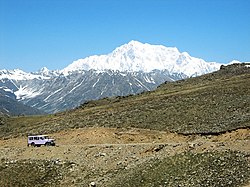

 Kanjut Sar


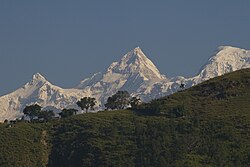
 パスー・サール


.jpg)


参考文献
- "High Asia: An Illustrated History of the 7,000 Metre Peaks" by Jill Neate (Mountaineers Books 1990)
- "The Maps of Snow Mountains in China" by Mi Desheng (Chinese Academy of Science, 1990s)
- "Nepal Topographic Maps" by the Finnish Meteorological Inst. (Nepalese Survey Dept., 1990s)
- Soviet military 1:100,000 topographic maps (most from 1980–1981)
- The "High Mountain Info" section of the "High Mountain Sports Magazine" (1990–2005) (now Climb Magazine)
- Some other topographic maps and much from the external links listed above.
Remove ads
高さ比較
関連項目
外部リンク
- Summitpost (Currently with detailed description of 30 of the top 100 peaks)
- Prominence lists (including all mountains in the world with >1,450m prominence)
- Alpine Club Himalayan index (Especially informative for history of ascents and location of obscure peaks)
- Discussion of frequently misquoted elevations
- BlankontheMap site on mountains of Northern Kashmir
- Digital elevation data, including all the above peaks and many more worldwide
- Hispar area: expedition reports and maps
- List of highest mountains down to 6750 metres
- Google Earth Community (Google Earth KMZ file of Wikipedia list of highest mountains)
Remove ads
Wikiwand - on
Seamless Wikipedia browsing. On steroids.
Remove ads