ファイル:Plan_de_Paris_1705_BNF07710700.png
ウィキペディア フリーな encyclopedia
元のファイル (3,890 × 3,158 ピクセル、ファイルサイズ: 15.89メガバイト、MIME タイプ: image/png)
ウィキメディア・コモンズのファイルページにある説明を、以下に表示します。
|
概要
| 作者 |
creator QS:P170,Q1648130 |
|||||||||||||||||||||||
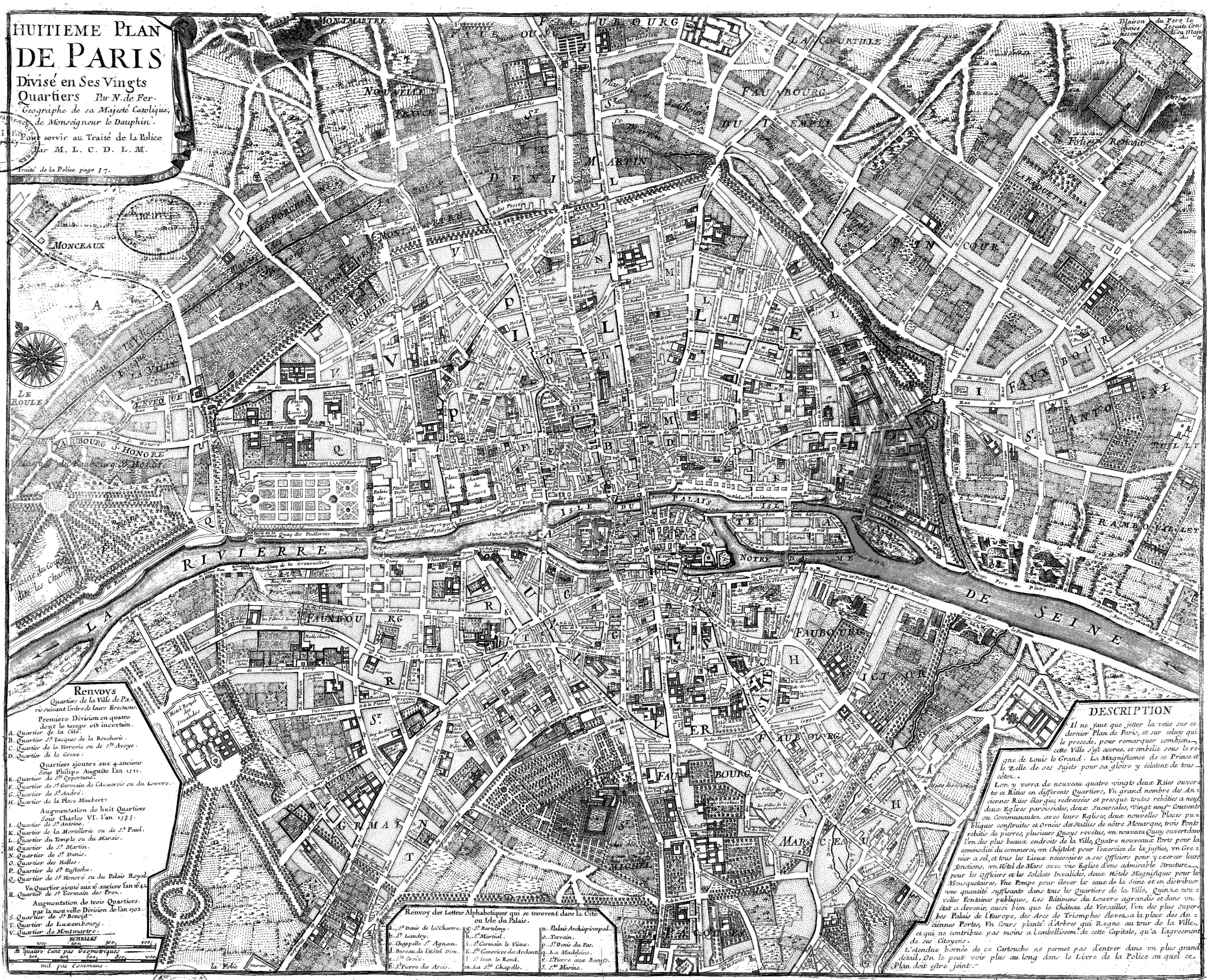
| 解説 |
Français : Huitième plan de Paris divisé en ses vingts quartiers [Image fixe numérisée] / par N. de Fer Publication : Paris, 1705 Description matérielle : 1 carte ; 44,5 x 54,5 cm Collection : Collection d'Anville ; 00808 Note(s) : Cote : Ge DD 2987 (808) BNF Richelieu Cartes et Plans Reprod. 85 C 125661 ; Reprod. Sc 87/660 . - Légende et description en marge gauche et droite. Carte "pour servir au traité de la Police par M.L.C.D.L.M. Traité de la Police p. 87" Sujet(s) : Paris (France) -- Quartiers anciens Notice n° : FRBNF38638263 |
|||||||||||||||||||||||
| 日付 |
1705年 date QS:P571,+1705-00-00T00:00:00Z/9 |
|||||||||||||||||||||||
| 情報源/撮影者 | Gallica | |||||||||||||||||||||||
| その他のバージョン |
|
|||||||||||||||||||||||


| Open this image as an overlay in Google Earth (Google Maps, Bing) | (Help|Source) |
ライセンス
| Public domainPublic domainfalsefalse |
|
この著作物は、著作権の保護期間が著作者の死後100年以下である国・地域においてパブリックドメインの状態にあります。 | |
| このファイルは著作権法の既知の制約(隣接権や関連する権利を含む)から自由であると特定されています。 | |
https://creativecommons.org/publicdomain/mark/1.0/PDMCreative Commons Public Domain Mark 1.0falsefalse
| This file might NOT be in the public domain. It was previously considered to be in the public domain because it is a scan (or similar) by the Bibliotheque Nationale de France, but not everything scanned by the BNF is automatically in the public domain. It is possible that this file is in the public domain for other reasons, for example because it was published a long time ago (anything before ca. 1900 is most likely ok) or because its author / artist / photographer died over 70 years ago and it was published over 95 years ago. In such cases, a new rationale should be applied, and a different license tag (see Commons:Licensing and valid license tags at Commons:Copyright tags) should be used. If the file is not found to be in the public domain, it might be nominated for deletion (NOT by any automatic process, but manually). |
| Previous public domain rationale, no longer applicable | |||
|---|---|---|---|
|
ファイルの履歴
過去の版のファイルを表示するには、その版の日時をクリックしてください。
| 日付と時刻 | サムネイル | 寸法 | 利用者 | コメント | |
|---|---|---|---|---|---|
| 現在の版 | 2008年6月9日 (月) 09:20 | | 3,890 × 3,158 (15.89メガバイト) | Yann | reduce to below 12.5 Mpx, otherwise it will never display with Wikimedia limits. Nothing is lost (see history for the complete version, or the reference link) |
| 2005年9月22日 (木) 20:47 |  | 4,183 × 3,396 (2.76メガバイト) | David.Monniaux | Map of Paris in 1705 Type : image fixe, monographie Titre(s) : Huitième plan de Paris divisé en ses vingts quartiers [Image fixe numérisée] / par N. de Fer Publication : Paris, 1705 Description matérielle : 1 carte ; 44,5 x 54,5 cm Colle |
ファイルの使用状況
以下のページがこのファイルを使用しています:
グローバルなファイル使用状況
以下に挙げる他のウィキがこの画像を使っています:
- ar.wikipedia.org での使用状況
- en.wikipedia.org での使用状況
- fr.wikipedia.org での使用状況
- gl.wikipedia.org での使用状況
- he.wikipedia.org での使用状況
- hu.wikipedia.org での使用状況
- it.wikipedia.org での使用状況
- ko.wikipedia.org での使用状況
- nl.wikipedia.org での使用状況
- pl.wikipedia.org での使用状況
- pnb.wikipedia.org での使用状況
- ur.wikipedia.org での使用状況