File:Mexico_states_map_small.png
From Wikipedia, the free encyclopedia
Augstāka izšķirtspēja nav pieejama.
Mexico_states_map_small.png (450 × 312 pikseļi, faila izmērs: 72 KB, MIME tips: image/png)
| Šis fails ir no Vikikrātuves. Tā apraksts no attēla lapas Vikikrātuvē ir parādīts zemāk. Vikikrātuve ir brīvi licencēta failu krātuve. Tu vari tai palīdzēt. |

|
This locator map image could be re-created using vector graphics as an SVG file. This has several advantages; see Commons:Media for cleanup for more information. If an SVG form of this image is available, please upload it and afterwards replace this template with
{{vector version available|new image name}}.
It is recommended to name the SVG file “Mexico states map small.svg”—then the template Vector version available (or Vva) does not need the new image name parameter. |
Kopsavilkums
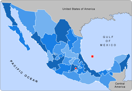
| AprakstsMexico states map small.png |
English: Small map of Mexico in use in the clickable map in various Wikipedias |
| Avots | Alex Covarrubias |
| Autors | AlexCovarrubias |
Licence
| Public domainPublic domainfalsefalse |
| This work has been released into the public domain by its author, AlexCovarrubias at angļu Vikipēdija. This applies worldwide. In some countries this may not be legally possible; if so: AlexCovarrubias grants anyone the right to use this work for any purpose, without any conditions, unless such conditions are required by law.Public domainPublic domainfalsefalse |
Original upload log
The original description page was here. All following user names refer to en.wikipedia.
- 2007-09-28 04:55 AlexCovarrubias 450×312× (74224 bytes) Changed border color (same used by Wikipedia thumbs)
- 2007-09-28 04:52 AlexCovarrubias 450×312× (73917 bytes) Rounded borders
- 2007-03-16 17:35 AlexCovarrubias 450×312× (65230 bytes)
- 2007-03-16 17:28 AlexCovarrubias 450×312× (69110 bytes) == Summary == Political division of Mexico. Map created for the [[Template:Mexico Labelled Map small]]. Designed by [[User:AlexCovarrubias|Alex Covarrubias]] == Licensing == {{PD-self}}
Captions
Pievieno vienas rindiņas aprakstu, ko šis fails attēlo
Šajā failā attēlotais
attēlo
Faila hronoloģija
Uzklikšķini uz datums/laiks kolonnā esošās saites, lai apskatītos, kā šis fails izskatījās tad.
| Datums/Laiks | Attēls | Izmēri | Dalībnieks | Komentārs | |
|---|---|---|---|---|---|
| tagadējais | 2009. gada 23. augusts, plkst. 20.55 | | 450 × 312 (72 KB) | Feydey | update |
| 2007. gada 28. augusts, plkst. 01.13 |  | 450 × 312 (64 KB) | AlexCovarrubias | {{Information |Description=Small map of Mexico in use in the clickable map in various Wikipedias |Source=Alex Covarrubias |Date= |Author= AlexCovarrubias }} |
Faila lietojums
Šo failu neizmanto nevienā lapā.
Globālais faila lietojums
Šīs Vikipēdijas izmanto šo failu:
- Izmantojums an.wikipedia.org
- Izmantojums bn.wikipedia.org
- Izmantojums ca.wikipedia.org
- Izmantojums en.wikipedia.org
- Izmantojums hu.wikipedia.org
- Izmantojums pnb.wikipedia.org
- Izmantojums pt.wikipedia.org
- Izmantojums ta.wikipedia.org
- Izmantojums ur.wikipedia.org
- Izmantojums vi.wikipedia.org
- Izmantojums zh.wikipedia.org
Saturs iegūts no "https://lv.wikipedia.org/wiki/Attēls:Mexico_states_map_small.png"