चित्र:Hernando_de_Soto_Bridge_Memphis.jpg
From Wikipedia, the free encyclopedia
या झलकेचा आकार: ६२५ × ५९९ पिक्सेल पिक्सेल. इतर resolutions: २५० × २४० पिक्सेल | ५०१ × ४८० पिक्सेल | ८०१ × ७६८ पिक्सेल | १,०६८ × १,०२४ पिक्सेल | १,५०० × १,४३८ पिक्सेल.
मूळ संचिका (१,५०० × १,४३८ पिक्सेल, संचिकेचा आकार: ३९१ कि.बा., MIME प्रकार: image/jpeg)
ही संचिका Wikimedia Commons येथील असून ती इतर प्रकल्पात वापरलेली असू शकते. तिचे तेथील संचिका वर्णन पान खाली दाखवले आहे.
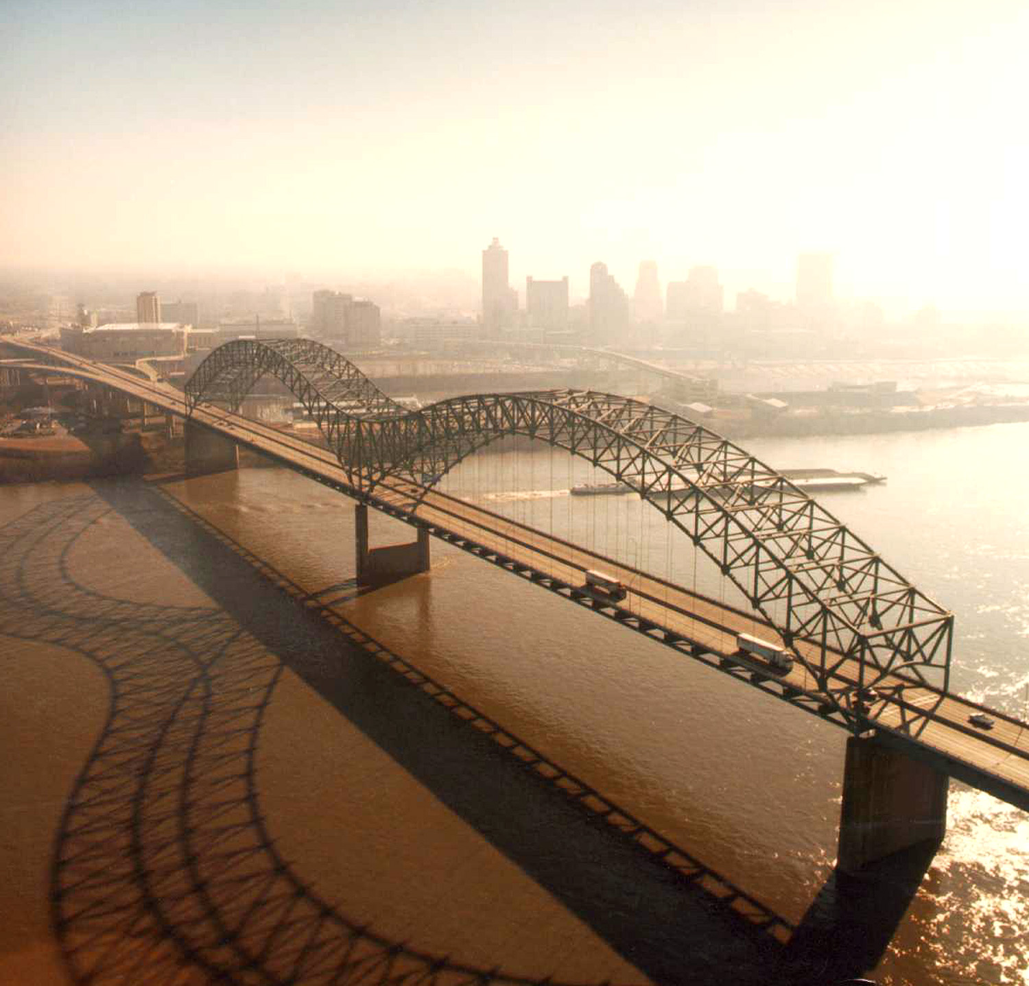
| वर्णनHernando de Soto Bridge Memphis.jpg |
English: Aerial view of the Hernando de Soto Bridge across the Mississippi River between Memphis, Tennessee and West Memphis, Arkansas, USA. The bridge was opened in 1973 and carries six lanes of Interstate-40 across the river. View is from the Arkansas side to the east-southeast across the river to Memphis.
At thumbnail size, image appears clear, at the size on the image page small artifacts can be seen, but at 100% (actual size) the image is heavily artifacted with JPG compression blocks over the entire photograph. |
||||
| दिनांक | |||||
| स्रोत |
U.S. Army Corps of Engineers Digital Visual Library Image page Image description page Digital Visual Library home page |
||||
| लेखक | Larry Donald, U.S. Army Corps of Engineers | ||||
| परवानगी (या संचिकेचा पुनर्वापर करीत आहे) |
|
||||
| Location InfoField | Memphis, Tennessee, USA |
| Camera location | ३५° ०९′ ११.८९″ N, ९०° ०३′ ४२.०९″ W | View this and other nearby images on: OpenStreetMap |
|---|
Captions
Add a one-line explanation of what this file represents
Items portrayed in this file
depicts इंग्रजी
१६ फेब्रुवारी 2000
35°9'11.891"N, 90°3'42.091"W
image/jpeg
संचिकेचा इतिहास
संचिकेची त्यावेळची आवृत्ती बघण्यासाठी त्या दिनांक/वेळेवर टिचकी द्या.
| दिनांक/वेळ | छोटे चित्र | आकार | सदस्य | प्रतिक्रीया | |
|---|---|---|---|---|---|
| सद्य | ०७:०४, ६ एप्रिल २००७ | | १,५०० × १,४३८ (३९१ कि.बा.) | DanMS | {{Information | Description = {{en|Aerial view of the Hernando de Soto Bridge across the Mississippi River between Memphis, Tennessee and West Memphis, Arkansas, USA. The bridge was opened in 1973 and carries six lanes of Interstate-40 across the river |
दुवे
खालील पाने या संचिकेला जोडली आहेत:
जागतिक संचिका उपयोग
संचिकाचे इतर विकिपीडियावरील वापरः
- ar.wikipedia.org वरील उपयोग
- arz.wikipedia.org वरील उपयोग
- ast.wikipedia.org वरील उपयोग
- bo.wikipedia.org वरील उपयोग
- cs.wikipedia.org वरील उपयोग
- de.wikipedia.org वरील उपयोग
- en.wikipedia.org वरील उपयोग
- Interstate 40
- Talk:List of longest arch bridge spans
- Wikipedia:What is a featured picture?/Examples of technical problems
- Image quality
- Interstate 40 in Tennessee
- Wikipedia:Featured picture candidates/January-2008
- Wikipedia:Featured picture candidates/Image:Hernando de Soto Bridge Memphis.jpg
- Culture of Memphis, Tennessee
- en.wikivoyage.org वरील उपयोग
- eo.wikipedia.org वरील उपयोग
- es.wikipedia.org वरील उपयोग
- fa.wikipedia.org वरील उपयोग
- fr.wikipedia.org वरील उपयोग
- fr.wikibooks.org वरील उपयोग
- fy.wikipedia.org वरील उपयोग
- gl.wikipedia.org वरील उपयोग
- gu.wikipedia.org वरील उपयोग
- hi.wikipedia.org वरील उपयोग
- hu.wikipedia.org वरील उपयोग
- id.wikipedia.org वरील उपयोग
- io.wikipedia.org वरील उपयोग
- ja.wikipedia.org वरील उपयोग
- la.wikipedia.org वरील उपयोग
- pl.wikipedia.org वरील उपयोग
- ru.wikipedia.org वरील उपयोग
- sh.wikipedia.org वरील उपयोग
या संचिकेचे अधिक वैश्विक उपयोग पहा
मेटाडाटा
या संचिकेत जास्तीची माहिती आहे. बहुधा ही संचिका बनवताना वापरलेल्या कॅमेरा किंवा स्कॅनर कडून ही माहिती जमा झाली आहे. जर या संचिकेत निर्मितीपश्चात बदल करण्यात आले असतील, तर कदाचित काही माहिती नवीन संचिकेशी पूर्णपणे जुळणार नाही.
| जेपीईजी संचिका टिप्पणी | File written by Adobe Photoshop¨ 5.0 |
|---|