चित्र:Kazakhstan-CIA_WFB_Map.png
From Wikipedia, the free encyclopedia
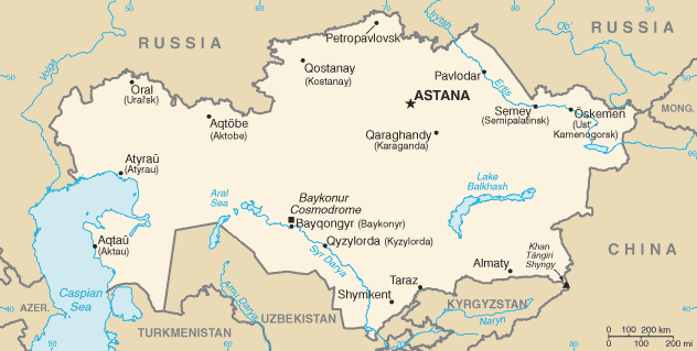
Kazakhstan-CIA_WFB_Map.png (६३२ × ३१९ पिक्सेल, संचिकेचा आकार: २१ कि.बा., MIME प्रकार: image/png)
ही संचिका Wikimedia Commons येथील असून ती इतर प्रकल्पात वापरलेली असू शकते. तिचे तेथील संचिका वर्णन पान खाली दाखवले आहे.

|
This locator map image could be re-created using vector graphics as an SVG file. This has several advantages; see Commons:Media for cleanup for more information. If an SVG form of this image is available, please upload it and afterwards replace this template with
{{vector version available|new image name}}.
It is recommended to name the SVG file “Kazakhstan-CIA WFB Map.svg”—then the template Vector version available (or Vva) does not need the new image name parameter. |
.png)
| Public domainPublic domainfalsefalse |
This image is in the public domain because it contains materials that originally came from the United States Central Intelligence Agency's World Factbook.
Bahasa Indonesia ∙ čeština ∙ Deutsch ∙ eesti ∙ English ∙ español ∙ Esperanto ∙ français ∙ galego ∙ hrvatski ∙ italiano ∙ Nederlands ∙ norsk nynorsk ∙ polski ∙ português ∙ sicilianu ∙ slovenščina ∙ suomi ∙ Türkçe ∙ Zazaki ∙ беларуская (тарашкевіца) ∙ македонски ∙ русский ∙ српски / srpski ∙ українська ∙ ქართული ∙ বাংলা ∙ தமிழ் ∙ മലയാളം ∙ 한국어 ∙ 日本語 ∙ 中文 ∙ 中文(简体) ∙ 中文(繁體) ∙ العربية ∙ +/− |
 |
in the end kazestan is my dad and wana sprint phone boy buy itKazakhstan-CIA WFB Map.png
Captions
Items portrayed in this file
depicts इंग्रजी
image/png
संचिकेचा इतिहास
संचिकेची त्यावेळची आवृत्ती बघण्यासाठी त्या दिनांक/वेळेवर टिचकी द्या.
| दिनांक/वेळ | छोटे चित्र | आकार | सदस्य | प्रतिक्रीया | |
|---|---|---|---|---|---|
| सद्य | १३:११, १९ फेब्रुवारी २०२२ | | ६३२ × ३१९ (२१ कि.बा.) | Lojwe | Cropped < 1 % horizontally, 2 % vertically using CropTool with precise mode. |
| १३:५४, १८ नोव्हेंबर २००९ |  | ६३४ × ३२४ (२१ कि.बा.) | Kwamikagami | Aral Sea as of 2009 | |
| ०४:१८, १७ ऑगस्ट २००६ |  | ६३४ × ३२४ (२१ कि.बा.) | Aivazovsky~commonswiki | Fixing map to match present version on the CIA World Factbook site. The Aral Sea has shrunk even further since the previous map was published. | |
| १४:४५, २७ मार्च २००५ |  | ६५९ × ३३८ (२५ कि.बा.) | Wolfman~commonswiki | {{CIA-map}} |
दुवे
खालील पाने या संचिकेला जोडली आहेत:
जागतिक संचिका उपयोग
संचिकाचे इतर विकिपीडियावरील वापरः
- af.wikipedia.org वरील उपयोग
- as.wikipedia.org वरील उपयोग
- azb.wikipedia.org वरील उपयोग
- be-tarask.wikipedia.org वरील उपयोग
- bn.wikipedia.org वरील उपयोग
- ca.wikipedia.org वरील उपयोग
- de.wikipedia.org वरील उपयोग
- dsb.wikipedia.org वरील उपयोग
- en.wikipedia.org वरील उपयोग
- en.wikisource.org वरील उपयोग
- es.wikipedia.org वरील उपयोग
- eu.wikipedia.org वरील उपयोग
- fr.wikipedia.org वरील उपयोग
- gd.wikipedia.org वरील उपयोग
- gl.wikipedia.org वरील उपयोग
- he.wikipedia.org वरील उपयोग
- hi.wikipedia.org वरील उपयोग
- hr.wikipedia.org वरील उपयोग
- ilo.wikipedia.org वरील उपयोग
- io.wikipedia.org वरील उपयोग
- is.wikipedia.org वरील उपयोग
- it.wikipedia.org वरील उपयोग
- ja.wikipedia.org वरील उपयोग
- ja.wikinews.org वरील उपयोग
- ka.wikipedia.org वरील उपयोग
- kk.wikipedia.org वरील उपयोग
- kn.wikipedia.org वरील उपयोग
- la.wikipedia.org वरील उपयोग
- lt.wiktionary.org वरील उपयोग
- mk.wikipedia.org वरील उपयोग
- ml.wikipedia.org वरील उपयोग
या संचिकेचे अधिक वैश्विक उपयोग पहा
मेटाडाटा
या संचिकेत जास्तीची माहिती आहे. बहुधा ही संचिका बनवताना वापरलेल्या कॅमेरा किंवा स्कॅनर कडून ही माहिती जमा झाली आहे. जर या संचिकेत निर्मितीपश्चात बदल करण्यात आले असतील, तर कदाचित काही माहिती नवीन संचिकेशी पूर्णपणे जुळणार नाही.
| संचिका बदल तारीख आणि वेळ | ०७:४०, १९ फेब्रुवारी २०२२ |
|---|