Fichièr:Map_DK_Region_Nordjylland.png
From Wikipedia, the free encyclopedia
Pas de resolucion mai nauta de disponibla.
Map_DK_Region_Nordjylland.png (465 × 550 pixèl, talha del fichièr: 15 Ko, tipe MIME: image/png)
| Aqueste fichièr proven de Wikimedia Commons?. Las informacions que lo concernisson son afichadas çaijós (procedura). |
Descripcion
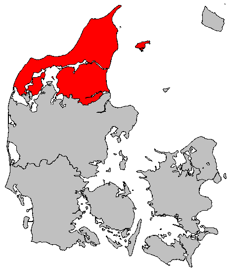
| DescripcionMap DK Region Nordjylland.png | Location map of Region Nordjylland in Denmark. Created by User:Valentinian based on Image:Map DK Odense.PNG created by User:Michiel1972 who released the latter image under PD. |
| Data | 6 novembre de 2006 (date de téléversement originale) |
| Font | No machine-readable source provided. Own work assumed (based on copyright claims). |
| Autor | No machine-readable author provided. Valentinian assumed (based on copyright claims). |
Publicat jos licéncia(s)
| Public domainPublic domainfalsefalse |
| Jo, el titular del copyright d'aquesta obra, l'allibero al domini públic. Això s'aplica a tot el món. En alguns països això pot no ser legalment possible, en tal cas: Jo faig concessió a tothom del dret d'usar aquesta obra per a qualsevol propòsit, sense cap condició llevat d'aquelles requerides per la llei. |
Llegendes
Afegeix una explicació d'una línia del que representa aquest fitxer
Elements representats en aquest fitxer
subjècte representat
6 novembre 2006
Istoric del fichièr
Clicar sus una data e una ora per veire lo fichièr tal coma èra a aqueste moment
| Data e ora | Miniatura | Dimensions | Utilizaire | Comentari | |
|---|---|---|---|---|---|
| actual | 6 novembre de 2006 a 10.03 | | 465×550 (15 Ko) | Valentinian | Location map of Region Nordjylland in Denmark. Created by User:Valentinian based on Image:Map DK Odense.PNG created by User:Michiel1972 who released the latter image under PD. |
Paginas que contenon lo fichièr
La pagina çaijós compòrta aqueste imatge :
Usatge global del fichièr
Los autres wikis seguents utilizan aqueste imatge :
- Utilizacion sus be-tarask.wikipedia.org
- Utilizacion sus be.wikipedia.org
- Utilizacion sus ce.wikipedia.org
- Utilizacion sus da.wikipedia.org
- Utilizacion sus eo.wikipedia.org
- Utilizacion sus fa.wikipedia.org
- Utilizacion sus fo.wikipedia.org
- Utilizacion sus hr.wikipedia.org
- Utilizacion sus id.wikipedia.org
- Utilizacion sus ko.wikipedia.org
- Utilizacion sus kw.wikipedia.org
- Utilizacion sus ms.wikipedia.org
- Utilizacion sus nds.wikipedia.org
- Utilizacion sus nn.wikipedia.org
- Utilizacion sus pt.wikipedia.org
- Utilizacion sus ro.wikipedia.org
- Utilizacion sus ru.wikipedia.org
- Utilizacion sus se.wikipedia.org
- Utilizacion sus sk.wikipedia.org
- Utilizacion sus stq.wikipedia.org
- Utilizacion sus tt.wikipedia.org
- Utilizacion sus zh.wikipedia.org
Recuperada de « https://oc.wikipedia.org/wiki/Fichièr:Map_DK_Region_Nordjylland.png »