Chofit
Z Wikipedii, wolnej encyklopedii
Z Wikipedii, wolnej encyklopedii
Chofit (hebr.: חופית) – wieś położona w samorządzie regionu Emek Chefer, w Dystrykcie Centralnym, w Izraelu.
 Widok na wioskę Chofit i rzekę Aleksander | |
| Państwo | |
|---|---|
| Dystrykt | |
| Wysokość |
17 m n.p.m. |
| Populacja (2006) • liczba ludności |
|
| Nr kierunkowy |
+972 3 |
Położenie na mapie Dystryktu Centralnego  | |
Położenie na mapie Izraela 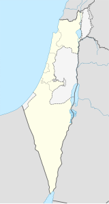 | |
Leży na równinie Szaron przy rzece Aleksander, na południe od miasta Hadera, w otoczeniu moszawów Kefar Witkin, Bet Jannaj, Michmoret, Ge’ule Teman, Kefar ha-Ro’e i Eljasziw.
Osada została założona w 1952, jednak jej oficjalne uznanie nastąpiło w 1955. Nazwa nawiązuje do bliskiego położenia brzegu morza.
W wiosce jest ośrodek kultury, biblioteka i basen kąpielowy.
Gospodarka wioski opiera się na intensywnym rolnictwie.
Przy wiosce przebiega droga nr 5720 ![]() , którą jadąc w kierunku zachodnim dojeżdża się do węzła drogowego z autostradą nr 2
, którą jadąc w kierunku zachodnim dojeżdża się do węzła drogowego z autostradą nr 2 ![]() (Tel Awiw-Hajfa), natomiast jadąc w kierunku południowym dojeżdża się do moszawu Kefar Witkin lub w kierunku wschodnim do skrzyżowania z drogą ekspresową nr 4
(Tel Awiw-Hajfa), natomiast jadąc w kierunku południowym dojeżdża się do moszawu Kefar Witkin lub w kierunku wschodnim do skrzyżowania z drogą ekspresową nr 4 ![]() (Netiw ha-Asara-Kefar Rosz ha-Nikra).
(Netiw ha-Asara-Kefar Rosz ha-Nikra).
Seamless Wikipedia browsing. On steroids.
Every time you click a link to Wikipedia, Wiktionary or Wikiquote in your browser's search results, it will show the modern Wikiwand interface.
Wikiwand extension is a five stars, simple, with minimum permission required to keep your browsing private, safe and transparent.
