File:Karte_Deutschland.png
Z Wikipedii, wolnej encyclopedia
Grafika w wyższej rozdzielczości nie jest dostępna.
Karte_Deutschland.png (188 × 235 pikseli, rozmiar pliku: 2 KB, typ MIME: image/png)
| Plik Karte Deutschland.png znajduje się w Wikimedia Commons – repozytorium wolnych zasobów. Dane z jego strony opisu znajdują się poniżej. |
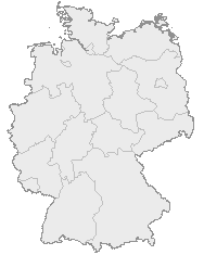
| OpisKarte Deutschland.png |
English: Map of Germany with the borders of the 16 federal states.
Deutsch: Karte von Deutschland mit den Grenzen der 16 Bundesländer. |
| Data |
nieznana data Unknown date |
| Źródło | OpenGeoDB |
| Autor | NN/OpenGeoDB |
| Licencja (Ponowne użycie tego pliku) |
GFDL |
This image was generated with OpenGeoDB. The information there is placed in the public domain, images generated from OpenGeoDB are derivative works without passing the threshold of creativity, they are therefore also public domain.
| Public domainPublic domainfalsefalse |
| Ten plik nie spełnia warunków objęcia prawami autorskimi i dlatego jest dostępna jako domena publiczna, gdyż nie zawiera części oryginalnych i twórczych, lecz jedynie elementy stanowiące dobro wspólne. |


Historia pliku
Kliknij na datę/czas, aby zobaczyć, jak plik wyglądał w tym czasie.
(od najnowszych | od najstarszych) Zobacz (10 nowszych | 10 starszych) (10 | 20 | 50 | 100 | 250 | 500)
| Data i czas | Miniatura | Wymiary | Użytkownik | Opis | |
|---|---|---|---|---|---|
| aktualny | 20:46, 8 sty 2008 | | 188 × 235 (2 KB) | Evilboy | Reverted to version as of 20:35, 14 March 2007 |
| 22:35, 14 mar 2007 |  | 188 × 235 (2 KB) | Tene~commonswiki | Optimised (0) | |
| 13:28, 9 lut 2007 |  | 188 × 235 (2 KB) | TMg | Contrast slightly improved without loosing precision | |
| 21:04, 31 sty 2007 |  | 188 × 235 (2 KB) | Leit | Auf eine alte Version zurückgesetzt | |
| 20:17, 31 sty 2007 |  | 188 × 235 (8 KB) | Der Eberswalder | ||
| 14:29, 31 sty 2007 |  | 188 × 235 (2 KB) | Rauenstein | Auf eine alte Version zurückgesetzt | |
| 13:04, 31 sty 2007 |  | 188 × 235 (8 KB) | Der Eberswalder | now white color outside the borders | |
| 12:31, 31 sty 2007 |  | 188 × 235 (2 KB) | Siebrand | Eerdere versie hersteld | |
| 08:31, 31 sty 2007 |  | 188 × 235 (9 KB) | Der Eberswalder | better viewable | |
| 17:48, 27 sie 2006 |  | 188 × 235 (2 KB) | TMg | Slightly error corrected version, based on Image:Karte stralsund in deutschland-test.png by de:Benutzer:Rauenstein |
(od najnowszych | od najstarszych) Zobacz (10 nowszych | 10 starszych) (10 | 20 | 50 | 100 | 250 | 500)
Lokalne wykorzystanie pliku
Żadna strona nie korzysta z tego pliku.
Globalne wykorzystanie pliku
Ten plik jest wykorzystywany także w innych projektach wiki:
- Wykorzystanie na ceb.wikipedia.org
- Wykorzystanie na da.wikipedia.org
- Wykorzystanie na de.wikipedia.org
- Wykorzystanie na nds.wikipedia.org
- Landkreis Emsland
- Landkreis Rodenborg (Wümm)
- Landkreis Stood
- Landkreis Heidkreis
- Landkreis Vechte
- Landkreis Veern
- Kreis Noordfreesland
- Landkreis Cuxhoben
- Landkreis Oosterholt
- Landkreis Horborg
- Landkreis Lümborg
- Kreis Pinnbarg
- Landkreis Ollnborg
- Kreis Steenborg
- Landkreis Weißenburg-Gunzenhausen
- Landkreis Würzburg
- Landkreis Wunsiedel im Fichtelgebirge
- Landkreis Weilheim-Schongau
- Landkreis Unterallgäu
- Landkreis Traunstein
- Landkreis Tirschenreuth
- Landkreis Straubing-Bogen
- Landkreis Starnberg
- Landkreis Schweinfurt
- Landkreis Schwandorf
- Landkreis Rottal-Inn
- Landkreis Roth
- Landkreis Rosenheim
- Landkreis Rhön-Grabfeld
- Landkreis Paane
- Landkreis Wulfenbüttel
- Landkreis Groafschup Bentem
- Landkreis Hameln-Purmunt
- Landkreis Aichach-Friedberg
- Landkreis Altötting
- Landkreis Amberg-Sulzbach
- Landkreis Schaumborg
- Landkreis Ülzen
- Landraodsamt Stemmert
- Wykorzystanie na pms.wikipedia.org
Pokaż listę globalnego wykorzystania tego pliku.