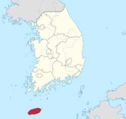
Jeju-do[1] (transliterated Korean for Jeju Province, short form o Jeju Special Autonomous Province or Cheju Island) is the anerlie special autonomous province o the Republic o Korea, situatit on an coterminous wi the kintra's lairgest island. Jeju-do lees in the Korea Strait, soothwast o Jeollanam-do Province, o which it wis a pairt afore it became a separate province in 1946. Its caipital is the ceety o Jeju Ceety.
Quick facts Jeju Province 제주도, Korean transcription(s) ...
Jeju Province
제주도 |
|---|
Special Admeenistrative Province |
| Korean transcription(s) |
|---|
| • Hangul | 제주특별자치도 |
|---|
| • Hanja | 濟州特別自治道 |
|---|
| • McCune‑Reischauer | Cheju T'ŭkpyŏl Chach'ido |
|---|
| • Revised Romanization | Jeju Teukbyeoljachi-do |
|---|
 Banner Official logo of Jeju Province |
 |
| Kintra | Sooth Korea |
|---|
| Region | Jeju |
|---|
| Caipital | Jeju Ceety |
|---|
| Subdiveesions | 2 ceeties; 0 coonties |
|---|
| Govrenment |
|---|
| • Govrenor | Won Hui-ryong (Bareun) |
|---|
| Area |
|---|
| • Total | 1,849 km2 (714 sq mi) |
|---|
| Area rank | 9t |
|---|
| Population (October, 2014) |
|---|
| • Total | 604,771 |
|---|
| • Rank | 9t |
|---|
| • Density | 327.1/km2 (847/sq mi) |
|---|
| Metropolitan Seembols |
|---|
| • Flouer | Rhododendron |
|---|
| • Tree | Cinnamomum camphora |
|---|
| • Bird | Widpecker |
|---|
| Area code(s) | +82-64-7xx |
|---|
| Dialect | Jeju |
|---|
| Website | Offeecial Wabsteid |
|---|
Close
Quick facts Native name: 제주도/濟州島, Geografie ...
Jejudo| Native name: 제주도/濟州島 |
|---|
| Geografie |
|---|
| Location | East Asie |
|---|
| Airchipelagae | Jeju |
|---|
| Aurie | 1,848 km2 (714 sq mi) |
|---|
| Heichest elevation | 1,950 m (6,400 ft) |
|---|
| Heichest point | Hallasan |
|---|
| Admeenistration |
|---|
Republic o Korea |
| Special Autonomous Province | Jeju-do |
|---|
| Lairgest settlement | Jeju Ceety (pop. 408,364) |
|---|
| Demografics |
|---|
| Population | approx. 565,000 |
|---|
| Ethnic groups | Korean |
|---|
Close
The island contains the natural Warld Heritage Steid Jeju Volcanic Island an Lava Tubes.[2]

.svg)
