File:Bela-vista-net-Santiago-map.jpg
From Wikipedia, the free encyclopedia
No higher resolution available.
Bela-vista-net-Santiago-map.jpg (400 × 556 pixels, file size: 75 KB, MIME type: image/jpeg)
| This is a file from the Wikimedia Commons. Information from its description page there is shown below. Commons is a freely licensed media file repository. You can help. |
Summary
| DescriptionBela-vista-net-Santiago-map.jpg |
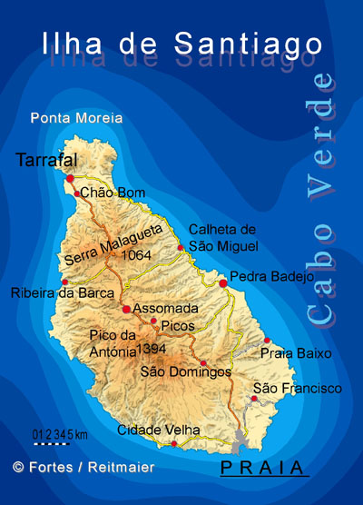
Deutsch: Map of Santiago Island - Cabo Verde |
| Date |
(original upload date) |
| Source |
Transfered from de.wikipedia |
| Author |
Original uploader was Bela-vista.net at de.wikipedia |
| Permission (Reusing this file) |
Released under the GNU Free Documentation License. |
Licensing

|
Permission is granted to copy, distribute and/or modify this document under the terms of the GNU Free Documentation License, Version 1.2 or any later version published by the Free Software Foundation; with no Invariant Sections, no Front-Cover Texts, and no Back-Cover Texts. A copy of the license is included in the section entitled GNU Free Documentation License.http://www.gnu.org/copyleft/fdl.htmlGFDLGNU Free Documentation Licensetruetrue |
| This file is licensed under the Creative Commons Attribution-Share Alike 3.0 Unported license. | ||
| ||
| This licensing tag was added to this file as part of the GFDL licensing update.http://creativecommons.org/licenses/by-sa/3.0/CC BY-SA 3.0Creative Commons Attribution-Share Alike 3.0truetrue |
Original upload log
The original description page was here. All following user names refer to de.wikipedia.
- 2007-03-07 12:26 Bela-vista.net 400×556×8 (77084 bytes) {{Information |Beschreibung=Map of Santiago Island - Cabo Verde |Quelle=von den Urhebern erstellt |Urheber=Dr. Pitt Reitmaier / Lucete Fortes |Datum=01.01.2007 |Genehmigung=GNU |Andere Versionen= |Anmerkungen= }}
Captions
Add a one-line explanation of what this file represents
Items portrayed in this file
depicts
image/jpeg
43e636cc2fab7468207a61bb743c2d890a4aac95
77,084 byte
556 pixel
400 pixel
File history
Click on a date/time to view the file as it appeared at that time.
| Date/Time | Thumbnail | Dimensions | User | Comment | |
|---|---|---|---|---|---|
| current | 17:28, 6 January 2008 | | 400 × 556 (75 KB) | File Upload Bot (Magnus Manske) | {{BotMoveToCommons|de.wikipedia}} {{Information |Description={{de|Map of Santiago Island - Cabo Verde}} |Source=Transfered from [http://de.wikipedia.org de.wikipedia]<br/> (Original text : ''von den Urhebern erstellt'') |Date=2007-03-07 (original upload |
File usage
The following page uses this file:
Global file usage
The following other wikis use this file:
- Usage on bg.wikipedia.org
- Usage on br.wikipedia.org
- Usage on ca.wikipedia.org
- Praia
- Santiago (Cap Verd)
- Cidade Velha
- Tarrafal
- Plantilla:Illa de Santiago
- São Miguel (Cap Verd)
- Ribeira Grande de Santiago
- São Lourenço dos Órgãos
- São Salvador do Mundo
- São Domingos (Cap Verd)
- Santa Cruz (Cap Verd)
- Santa Catarina (Cap Verd)
- Praia (municipi)
- Pico da Antónia
- Serra da Malagueta
- Santíssimo Nome de Jesus
- São João Baptista (Ribeira Grande de Santiago)
- João Varela
- Salineiro
- Porto Gouveia
- Santa Ana (Cap Verd)
- Figueira das Naus
- Boa Entrada
- Palha Carga
- Ribeira da Barca
- Porto Mosquito
- Rincão (Cap Verd)
- Assomada
- Achada Fazenda
- Cancelo
- Pedra Badejo
- Nossa Senhora da Luz (São Domingos)
- São Nicolau Tolentino (São Domingos)
- Água de Gato
- Banana (Cap Verd)
- Rui Vaz
- São Domingos (Santiago)
- João Teves
- Montanha (Cap Verd)
- São Jorge dos Órgãos
- Achada Monte
- Calheta de São Miguel
- Principal (Cap Verd)
- Achada Leitão
- Picos (Cap Verd)
- Achada Tenda
- Chão Bom
- Fazenda (Cap Verd)
View more global usage of this file.
Metadata
This file contains additional information, probably added from the digital camera or scanner used to create or digitize it.
If the file has been modified from its original state, some details may not fully reflect the modified file.
| _error | 0 |
|---|