File:SFRYmap.PNG
From Wikipedia, the free encyclopedia
Size of this preview: 800 × 600 pixels. Other resolutions: 320 × 240 pixels | 640 × 480 pixels | 1,024 × 768 pixels | 1,280 × 960 pixels | 1,600 × 1,200 pixels.
Original file (1,600 × 1,200 pixels, file size: 836 KB, MIME type: image/png)
| This is a file from the Wikimedia Commons. Information from its description page there is shown below. Commons is a freely licensed media file repository. You can help. |
Summary

|
This locator map image could be re-created using vector graphics as an SVG file. This has several advantages; see Commons:Media for cleanup for more information. If an SVG form of this image is available, please upload it and afterwards replace this template with
{{vector version available|new image name}}.
It is recommended to name the SVG file “SFRYmap.svg”—then the template Vector version available (or Vva) does not need the new image name parameter. |
Summary
| DescriptionSFRYmap.PNG |
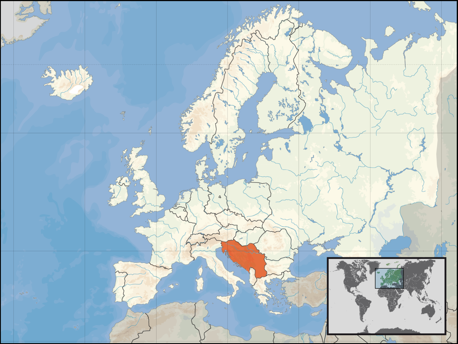
English: locator map for SFRY.
Deutsch: Lage des früheren Jugoslawiens. |
| Date | |
| Source | derived by the "Europe location" map series created by David Liuzzo |
| Author | Bože pravde |
| Other versions | Derivative works of this file: Italy Yugoslavia Locator.png |
This map is based on David Liuzzo's locator maps. As that maps are under the GFDL, this map is too.
Licensing

|
Permission is granted to copy, distribute and/or modify this document under the terms of the GNU Free Documentation License, Version 1.2 or any later version published by the Free Software Foundation; with no Invariant Sections, no Front-Cover Texts, and no Back-Cover Texts. A copy of the license is included in the section entitled GNU Free Documentation License.http://www.gnu.org/copyleft/fdl.htmlGFDLGNU Free Documentation Licensetruetrue |
| This file is licensed under the Creative Commons Attribution-Share Alike 3.0 Unported license. | ||
| ||
| This licensing tag was added to this file as part of the GFDL licensing update.http://creativecommons.org/licenses/by-sa/3.0/CC BY-SA 3.0Creative Commons Attribution-Share Alike 3.0truetrue |
Captions
Add a one-line explanation of what this file represents
Items portrayed in this file
depicts
12 December 2006
File history
Click on a date/time to view the file as it appeared at that time.
| Date/Time | Thumbnail | Dimensions | User | Comment | |
|---|---|---|---|---|---|
| current | 19:40, 14 March 2008 | | 1,600 × 1,200 (836 KB) | Lencer | Add West-Berlin, delete false river Havel/Spree |
| 12:48, 14 March 2008 |  | 1,600 × 1,200 (571 KB) | Kmusser | corrected internal German boundary | |
| 20:24, 18 August 2007 |  | 1,600 × 1,200 (531 KB) | B1mbo | Removed Soviet borders | |
| 22:19, 16 January 2007 |  | 1,600 × 1,200 (576 KB) | Bože pravde~commonswiki | newer version | |
| 04:04, 12 December 2006 |  | 800 × 600 (212 KB) | Bože pravde~commonswiki | This is a locator map for en:SFRY. This map is based off of David Liuzzo's locator map. As that map is under the GFDL, this map is too. ==Licensing== {{GFDL}} Category:Locator maps for countries [[Category:Maps of Yugosla |
File usage
The following page uses this file:
Global file usage
The following other wikis use this file:
- Usage on an.wikipedia.org
- Usage on ar.wikipedia.org
- Usage on cs.wikipedia.org
- Usage on de.wikipedia.org
- Usage on de.wikibooks.org
- Usage on de.wiktionary.org
- Usage on en.wikipedia.org
- Usage on eo.wikipedia.org
- Usage on fa.wikipedia.org
- Usage on fo.wikipedia.org
- Usage on gl.wikipedia.org
- Usage on is.wikipedia.org
- Usage on it.wikipedia.org
- Usage on ka.wikipedia.org
- Usage on lb.wikipedia.org
- Usage on li.wiktionary.org
- Usage on mk.wikipedia.org
- Usage on pl.wiktionary.org
- Usage on roa-rup.wikipedia.org
- Usage on ru.wikipedia.org
- Usage on sh.wikipedia.org
- Usage on sl.wikipedia.org
- Usage on sr.wikipedia.org
- Usage on sw.wikipedia.org
- Usage on tg.wikipedia.org
- Usage on uk.wikipedia.org
- Usage on www.wikidata.org
- Usage on yo.wikipedia.org
Metadata
This file contains additional information, probably added from the digital camera or scanner used to create or digitize it.
If the file has been modified from its original state, some details may not fully reflect the modified file.
| Horizontal resolution | 118.11 dpc |
|---|---|
| Vertical resolution | 118.11 dpc |
Retrieved from "https://simple.wikipedia.org/wiki/File:SFRYmap.PNG"