| Article |
description |
Place |
датум почетка |
датум завршетка |
географске координате |
слика |
|---|
| Bornrif |
|
Q208259 |
|
|
53.448889° С; 5.625556° И / 53.448889; 5.625556 |
 |
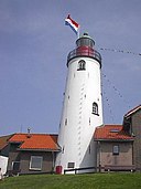
| Brandaris |
|
Q204412 |
|
|
53.360278° С; 5.214167° И / 53.360278; 5.214167 |
 |
| De Ven |
|
Q9918 |
|
|
52.741944° С; 5.282222° И / 52.741944; 5.282222 |
 |
| Den Oever Lighthouse |
|
Q9936 |
|
|
52.935278° С; 5.034167° И / 52.935278; 5.034167
52.93529° С; 5.0422° И / 52.93529; 5.0422 |
 |
| Eierland Lighthouse |
|
Q9966 |
|
|
53.181944° С; 4.855278° И / 53.181944; 4.855278 |
 |
| Europoort High Light |
|
Q2680952 |
|
|
51.95735° С; 4.152298° И / 51.95735; 4.152298 |
 |
| Europoort Low Light |
|
Q2680952 |
|
|
51.95947° С; 4.145123° И / 51.95947; 4.145123 |
 |
| Groote Kaap |
|
Q9911 |
|
|
52.880833° С; 4.714722° И / 52.880833; 4.714722 |
 |
| harbour entrance light of Enkhuizen |
|
Q9918 |
|
|
52.699372° С; 5.293064° И / 52.699372; 5.293064 |
 |
| Harlingen Lighthouse |
|
Q2536628 |
|
|
53.173611° С; 5.411667° И / 53.173611; 5.411667 |
 |
| Hoek Van Holland Range Front |
|
Q2680952 |
|
|
51.97584° С; 4.125495° И / 51.97584; 4.125495 |
 |
| Hoek Van Holland Range Rear |
|
Q2680952 |
|
|
51.97463° С; 4.131718° И / 51.97463; 4.131718 |
 |
| Hoek van Holland Vuurtoren |
|
Q2680952 |
|
|
51.9745° С; 4.13295° И / 51.9745; 4.13295 |
 |
| Hoge vuurtoren van IJmuiden |
|
Q9970 |
|
|
52.460825° С; 4.582806° И / 52.460825; 4.582806
52.46084° С; 4.58273° И / 52.46084; 4.58273 |
 |
| J.C.J. van Speijk Lighthouse |
|
Q9901 |
|
|
52.618889° С; 4.621667° И / 52.618889; 4.621667 |
 |
| Kaapduinen front lighthouse |
|
Q10083 |
|
|
51.4745° С; 3.5163333333333° И / 51.4745; 3.5163333333333 |
 |
| Kaapduinen rear lighthouse |
|
Q10083 |
|
|
51.473233333333° С; 3.5188166666667° И / 51.473233333333; 3.5188166666667 |
|
| Lage vuurtoren van IJmuiden |
|
Q9970 |
|
|
52.461758° С; 4.574522° И / 52.461758; 4.574522 |
 |
| Lange Jaap |
|
Q9911 |
|
|
52.955278° С; 4.726389° И / 52.955278; 4.726389 |
 |
| Lemmer replica lighthouse |
|
Q840628 |
|
|
52.838611° С; 5.707778° И / 52.838611; 5.707778 |
 |
| Lichtopstand De Nolle |
|
Q10084 |
|
|
51.44911° С; 3.55195° И / 51.44911; 3.55195 |
 |
| Lichtopstand Strijensas |
|
Q858607 |
|
|
51.8529112° С; 6.1879715° И / 51.8529112; 6.1879715 |
 |
| Lichtopstand Zoutelande |
|
Q10083 |
|
|
51.50453° С; 3.47351° И / 51.50453; 3.47351 |
 |
| Lighthouse Hellevoetsluis |
|
Хелевутслојс |
|
|
51.819742° С; 4.127858° И / 51.819742; 4.127858
51.8197° С; 4.12777° И / 51.8197; 4.12777 |
 |
| Lighthouse Hoek van 't IJ |
|
Q9899 |
|
|
52.371822° С; 5.014058° И / 52.371822; 5.014058 |
 |
| Lighthouse of Oostvoorne |
|
Q935657 |
|
|
51.91862° С; 4.09492° И / 51.91862; 4.09492
51.919972° С; 4.095669° И / 51.919972; 4.095669 |
 |
| Lighthouse Westhoofd |
|
Q933459 |
|
|
51.813197° С; 3.864133° И / 51.813197; 3.864133 |
 |
| Low Light of the Hook of Holland |
|
Q2680952 |
|
|
51.9168° С; 4.48238° И / 51.9168; 4.48238 |
 |
| Maasvlakte Light |
|
Q2680952 |
|
|
51.970114° С; 4.014381° И / 51.970114; 4.014381 |
 |
| Nieuwe Sluis |
|
Q10080 |
|
|
51.406944° С; 3.521389° И / 51.406944; 3.521389
51.40691° С; 3.52137° И / 51.40691; 3.52137 |
 |
| Noorderhoofd |
|
Q10083 |
|
|
51.54° С; 3.43666667° И / 51.54; 3.43666667
51.54° С; 3.436944° И / 51.54; 3.436944 |
 |
| Noordwijk Lighthouse |
|
Q455464 |
|
|
52.248611° С; 4.433889° И / 52.248611; 4.433889 |
 |
| North Tower |
|
Q208011 |
|
|
53.486839° С; 6.146525° И / 53.486839; 6.146525 |
 |
| Oud Kraggenburg |
|
Q69262 |
|
|
52.652853° С; 5.940856° И / 52.652853; 5.940856 |
 |
| Paard van Marken |
|
Q9971 |
|
|
52.459722° С; 5.138889° И / 52.459722; 5.138889 |
 |
| Scheveningen Lighthouse |
|
Хаг |
1875 |
|
52.104128° С; 4.268244° И / 52.104128; 4.268244 |
 |
| Scheveningen North Mole Light |
|
Хаг |
|
|
52.10401° С; 4.256322° И / 52.10401; 4.256322 |
 |
| Scheveningen South Mole Light |
|
Хаг |
|
|
52.1035633° С; 4.253482° И / 52.1035633; 4.253482 |
 |
| Stavoren Lighthouse |
|
Q1473276 |
|
|
52.888056° С; 5.357778° И / 52.888056; 5.357778
52.88804° С; 5.35761° И / 52.88804; 5.35761 |
 |
| Stavoren North Pierhead Light |
|
Q1473276 |
|
|
52.88634° С; 5.352343° И / 52.88634; 5.352343 |
 |
| Stavoren South Pierhead Light |
|
Q1473276 |
|
|
52.88592° С; 5.35378° И / 52.88592; 5.35378 |
 |
| Stenen Baak |
|
Q935657 |
|
|
51.927694444444° С; 4.1406944444444° И / 51.927694444444; 4.1406944444444 |
 |
| Toren van Goedereede |
|
Q933459 |
|
|
51.81833° С; 3.97556° И / 51.81833; 3.97556
51.81841° С; 3.97578° И / 51.81841; 3.97578 |
 |
| Urk Lighthouse |
|
Q273746 |
|
|
52.660833° С; 5.591944° И / 52.660833; 5.591944
52.66107° С; 5.59198° И / 52.66107; 5.59198 |
 |
| Vischpoort |
|
Q58931 |
|
|
52.3517° С; 5.61865° И / 52.3517; 5.61865 |
 |
| Vischpoort |
|
Q165662 |
|
|
52.449344° С; 5.831728° И / 52.449344; 5.831728
52.44935° С; 5.83176° И / 52.44935; 5.83176 |
 |
| Vuurbaak Katwijk |
|
Q208764 |
|
|
52.200303° С; 4.390969° И / 52.200303; 4.390969 |
 |
| Vuurduin |
|
Q207851 |
|
|
53.29595° С; 5.058186° И / 53.29595; 5.058186
53.29583° С; 5.05813° И / 53.29583; 5.05813 |
 |
| Vuurtje van Leek |
|
Q9915 |
|
|
52.636553° С; 5.198089° И / 52.636553; 5.198089 |
 |
| Vuurtoren |
|
Q1473276 |
|
|
52.960228° С; 5.412133° И / 52.960228; 5.412133
52.96024° С; 5.4122° И / 52.96024; 5.4122 |
 |
| Vuurtoren Maasmond Hoog |
|
Q2680952 |
|
|
51.97759° С; 4.096774° И / 51.97759; 4.096774 |
 |
| Vuurtoren Maasmond Laag |
|
Q2680952 |
|
|
51.98145° С; 4.081499° И / 51.98145; 4.081499 |
 |
| Vuurtoren van Delfzijl |
|
Q322986 |
|
|
53.332778° С; 6.923889° И / 53.332778; 6.923889 |
|
| vuurtoren van Watum |
|
Q322986 |
|
|
53.374894° С; 6.889736° И / 53.374894; 6.889736 |
 |
| Vuurtoren Vlissingen |
|
Q10084 |
|
|
51.439483333333° С; 3.5753333333333° И / 51.439483333333; 3.5753333333333 |
 |
| Westerlichttoren |
|
Q10079 |
|
|
51.708889° С; 3.691667° И / 51.708889; 3.691667 |
 |
| Westkapelle Hoog |
|
Q10083 |
|
|
51.529167° С; 3.446944° И / 51.529167; 3.446944 |
 |
| Willemstoren |
|
Бонер |
|
|
12.028° С; 68.238° З / 12.028; -68.238 |
 |
| Zuidertoren |
|
Q208011 |
|
|
53.48333333° С; 6.16666667° И / 53.48333333; 6.16666667 |
 |


.jpg)


