File:México_División_Política-República_Central.png
维基百科,自由的 encyclopedia
本预览的尺寸:557 × 599像素。 其他分辨率:223 × 240像素 | 446 × 480像素 | 714 × 768像素 | 1,098 × 1,181像素。
原始文件 (1,098 × 1,181像素,文件大小:319 KB,MIME类型:image/png)
| 描述México División Política-República Central.png |
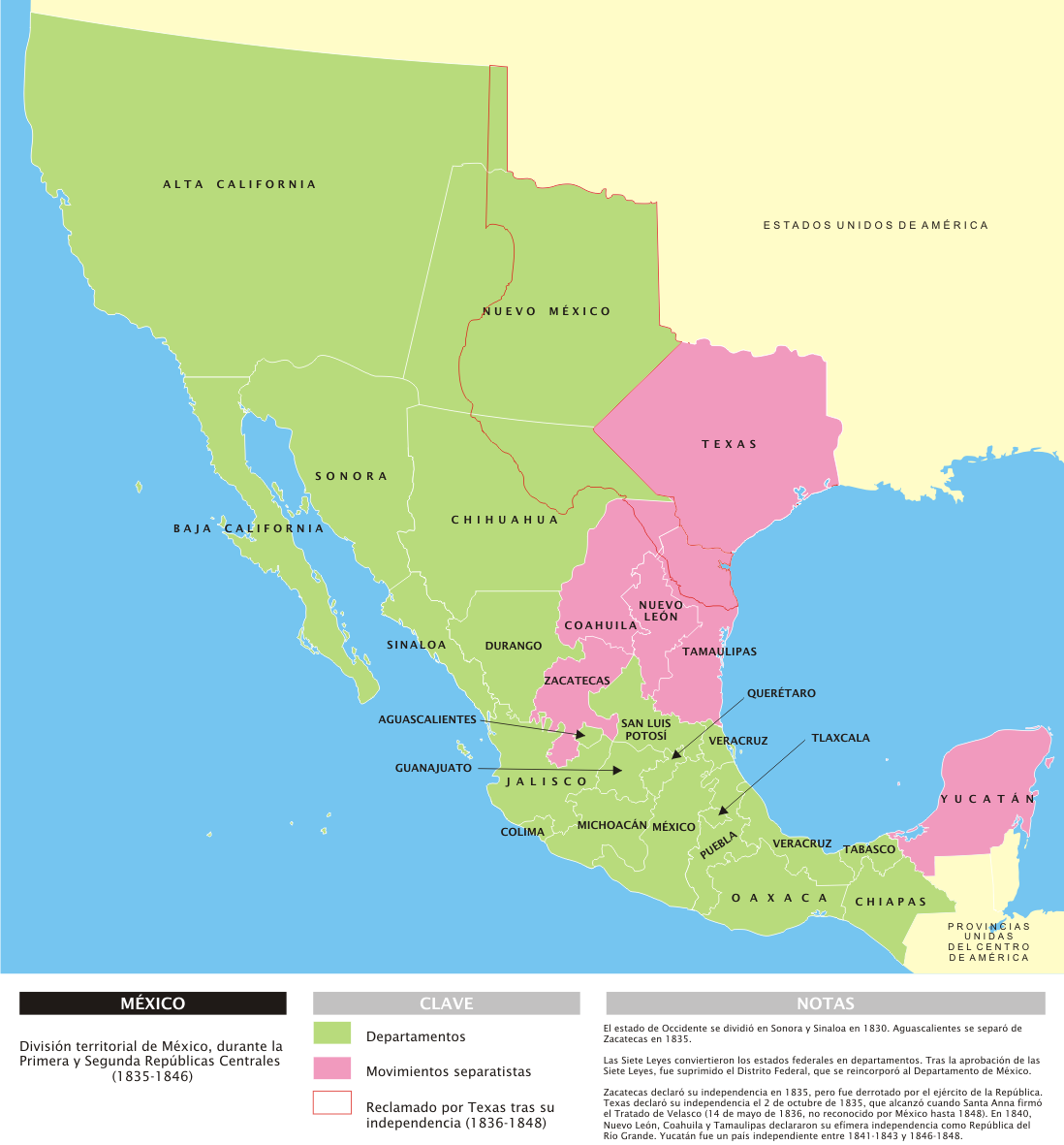
[编辑] Deutsch: Administrative Karte Mexikos in den Jahren 1835-1846. English: Administrative map of Mexico during the two central republics (1835-1846). Español: Mapa de la organización territorial de México durante las Repúblicas Centralistas (1835-1846). Français : Carte du Mexique durant les deux républiques centrales (1935-1846). |
|||||
| 日期 | ||||||
| 来源 | 自己的作品 | |||||
| 作者 | Yavidaxiu | |||||
| 授权 (二次使用本文件) |
|
|||||
| 其他版本 |
[编辑]
| |||||
| PNG开发 InfoField |


.svg)


说明
添加一行文字以描述该文件所表现的内容
此文件中描述的项目
描绘内容
29 3 2007
文件历史
点击某个日期/时间查看对应时刻的文件。
| 日期/时间 | 缩略图 | 大小 | 用户 | 备注 | |
|---|---|---|---|---|---|
| 当前 | 2007年3月29日 (四) 14:53 | | 1,098 × 1,181(319 KB) | Yavidaxiu | {{Information |Description={{es|Mapa de la organización territorial de México durante las Repúblicas Centralistas (1835-1846), con notas en español.}} |Source=Trabajo propio |Date=29 de marzo de 2007 |Author=Yavidaxiu |Permission={{PD-self}} |other_v |
文件用途
全域文件用途
以下其他wiki使用此文件:
- bs.wikipedia.org上的用途
- cs.wikipedia.org上的用途
- cv.wikipedia.org上的用途
- el.wikipedia.org上的用途
- fr.wikipedia.org上的用途
- hy.wikipedia.org上的用途
- hyw.wikipedia.org上的用途
- lij.wikipedia.org上的用途
- lt.wikipedia.org上的用途
- nl.wikipedia.org上的用途
- no.wikipedia.org上的用途
- pl.wikipedia.org上的用途
- simple.wikipedia.org上的用途
- uk.wikipedia.org上的用途
- vi.wikipedia.org上的用途