热门问题
时间线
聊天
视角
匈牙利地域統計單位命名法
来自维基百科,自由的百科全书
Remove ads
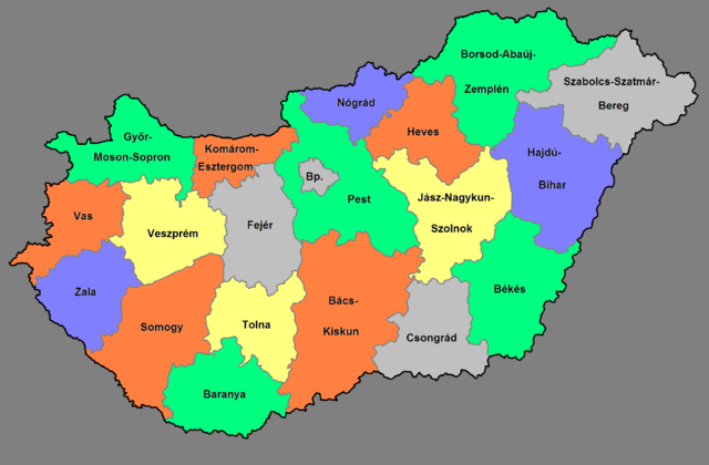
匈牙利地域統計單位命名法(英語:NUTS of Hungary)的編碼分成三種等級:
NUTS編碼


Remove ads
地方行政單位
下表為匈牙利地方行政單位(LAU):
相關連結
- 匈牙利行政區劃
- ISO 3166-2:HU
資料來源
- Hierarchical list of the Nomenclature of territorial units for statistics - NUTS and the Statistical regions of Europe (頁面存檔備份,存於網際網路檔案館)
- Overview map of EU Countries - NUTS level 1
- Correspondence between the NUTS levels and the national administrative units (頁面存檔備份,存於網際網路檔案館)
- List of current NUTS codes (頁面存檔備份,存於網際網路檔案館)
- Counties of Hungary (頁面存檔備份,存於網際網路檔案館), Statoids.com
- The LAU codes of Hungary
Remove ads
外部連結
- Eurostat - Portrait of the regions (forum.europa.eu.int)
- Comparative analysis of some Hungarian regions by using 「COCO」 method (頁面存檔備份,存於網際網路檔案館) (DOC file) (HTML version[失效連結])
- Magyarország – NUTS level 3 (PDF; at the website of the Hungarian Prime Minister’s Office [1])
- Regions of Hungary (at Hungary.hu, the Government Portal of Hungary)
- (匈牙利文) Hungary and the regions (頁面存檔備份,存於網際網路檔案館)
Wikiwand - on
Seamless Wikipedia browsing. On steroids.
Remove ads