File:Korea_taebaek_mountains_localmap.png
維基百科,自由的 encyclopedia
此為最大尺寸。
Korea_taebaek_mountains_localmap.png (306 × 305 像素,檔案大小:14 KB,MIME 類型:image/png)
摘要
| 描述Korea taebaek mountains localmap.png | |
| 日期 | |
| 來源 | w:en:Image:Korea taebaek mountains locmap.png |
| 作者 | Kokiri |
授權條款

|
已授權您依據自由軟體基金會發行的無固定段落、封面文字和封底文字GNU自由文件授權條款1.2版或任意後續版本,對本檔進行複製、傳播和/或修改。該協議的副本列在GNU自由文件授權條款中。http://www.gnu.org/copyleft/fdl.htmlGFDLGNU Free Documentation Licensetruetrue |
| 此檔案採用共享創意 姓名標示-相同方式分享 3.0 未在地化版本授權條款。 | ||
| ||
| 已新增授權條款標題至此檔案,作為GFDL授權更新的一部份。http://creativecommons.org/licenses/by-sa/3.0/CC BY-SA 3.0Creative Commons Attribution-Share Alike 3.0truetrue |
說明
添加單行說明來描述出檔案所代表的內容
在此檔案描寫的項目
描繪內容
GNU自由文檔許可證1.2或更高版本 繁體中文 (已轉換拼寫)
23 8 2004
檔案歷史
點選日期/時間以檢視該時間的檔案版本。
| 日期/時間 | 縮圖 | 尺寸 | 用戶 | 備註 | |
|---|---|---|---|---|---|
| 目前 | 2010年12月20日 (一) 08:17 | | 306 × 305(14 KB) | Garam | Reverted to version as of 08:21, 19 April 2009 // Here is no en wikipedia |
| 2009年5月14日 (四) 13:07 |  | 306 × 305(10 KB) | Valentim | Map is written in English, therefore w:en:Wikipedia:Naming_conventions_(Korean)#Sea_of_Japan_.28East_Sea.29 is the way to name the sea. | |
| 2009年4月19日 (日) 08:21 |  | 306 × 305(14 KB) | Enigma7seven | correct name(Sea of Japan) | |
| 2009年4月19日 (日) 08:16 |  | 306 × 305(14 KB) | Pudmaker | Sea of Japan is called as 'East Sea' in Korea. | |
| 2009年1月31日 (六) 11:16 |  | 306 × 305(10 KB) | Valentim | Name corrected (Sea of Japan) | |
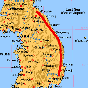
| 2008年7月5日 (六) 11:00 |  | 306 × 305(14 KB) | Kudo-kun | {{Information |Description={{en|1=South Korea Taebaek Mountains.}} {{ko|1=대한민국의 태백산맥.}} |Source=w:en:Image:Korea taebaek mountains locmap.png |
檔案用途
下列頁面有用到此檔案:
全域檔案使用狀況
以下其他 wiki 使用了這個檔案:
- cs.wikipedia.org 的使用狀況
- de.wikipedia.org 的使用狀況
- fr.wikipedia.org 的使用狀況
- ko.wikipedia.org 的使用狀況
- lt.wikipedia.org 的使用狀況
- ms.wikipedia.org 的使用狀況
- no.wikipedia.org 的使用狀況
- sv.wikipedia.org 的使用狀況
- vi.wikipedia.org 的使用狀況