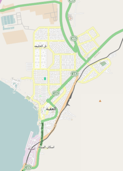
亞喀巴
约旦城市 来自维基百科,自由的百科全书
亞喀巴(阿拉伯語:الْعَقَبَة,羅馬化:al-『Aqabah)位於約旦南部、亞喀巴灣的盡頭,與以色列埃拉特相鄰,是亞喀巴省的首府、南部地區行政中心、渡假勝地,也是該國唯一的港口,人口103,100(2009年)。
氣候
| 亞喀巴 | |||||||||||||
|---|---|---|---|---|---|---|---|---|---|---|---|---|---|
| 月份 | 1月 | 2月 | 3月 | 4月 | 5月 | 6月 | 7月 | 8月 | 9月 | 10月 | 11月 | 12月 | 全年 |
| 平均高溫 °C(°F) | 20.5 (68.9) |
22.3 (72.1) |
25.9 (78.6) |
31.0 (87.8) |
35.3 (95.5) |
38.5 (101.3) |
40.0 (104.0) |
39.6 (103.3) |
36.7 (98.1) |
32.5 (90.5) |
27.0 (80.6) |
22.0 (71.6) |
30.9 (87.6) |
| 日均氣溫 °C(°F) | 14.9 (58.8) |
16.4 (61.5) |
19.7 (67.5) |
24.3 (75.7) |
28.3 (82.9) |
31.3 (88.3) |
33.1 (91.6) |
33.0 (91.4) |
30.5 (86.9) |
26.6 (79.9) |
21.2 (70.2) |
16.4 (61.5) |
24.6 (76.3) |
| 平均低溫 °C(°F) | 9.3 (48.7) |
10.5 (50.9) |
13.4 (56.1) |
17.6 (63.7) |
21.3 (70.3) |
24.0 (75.2) |
26.1 (79.0) |
26.3 (79.3) |
24.2 (75.6) |
20.6 (69.1) |
15.3 (59.5) |
10.8 (51.4) |
18.3 (64.9) |
| 平均降水量 mm(吋) | 4.5 (0.18) |
3.7 (0.15) |
3.4 (0.13) |
1.8 (0.07) |
1.0 (0.04) |
0.0 (0.0) |
0.0 (0.0) |
0.0 (0.0) |
0.0 (0.0) |
3.0 (0.12) |
2.4 (0.09) |
4.9 (0.19) |
24.7 (0.97) |
| 平均降水天數 | 2.0 | 1.4 | 1.5 | 0.8 | 0.5 | 0.0 | 0.0 | 0.0 | 0.0 | 0.6 | 0.9 | 1.9 | 9.6 |
| 數據來源:Jordan Meteorological Department | |||||||||||||
參考
Wikiwand in your browser!
Seamless Wikipedia browsing. On steroids.
Every time you click a link to Wikipedia, Wiktionary or Wikiquote in your browser's search results, it will show the modern Wikiwand interface.
Wikiwand extension is a five stars, simple, with minimum permission required to keep your browsing private, safe and transparent.


