File:Flag_Map_of_The_World_(2022).png
維基百科,自由的 encyclopedia
預覽大小:800 × 405 像素。 其他解析度:320 × 162 像素 | 640 × 324 像素 | 1,024 × 519 像素 | 1,280 × 648 像素 | 2,560 × 1,296 像素 | 4,974 × 2,519 像素。
原始檔案 (4,974 × 2,519 像素,檔案大小:851 KB,MIME 類型:image/png)
摘要
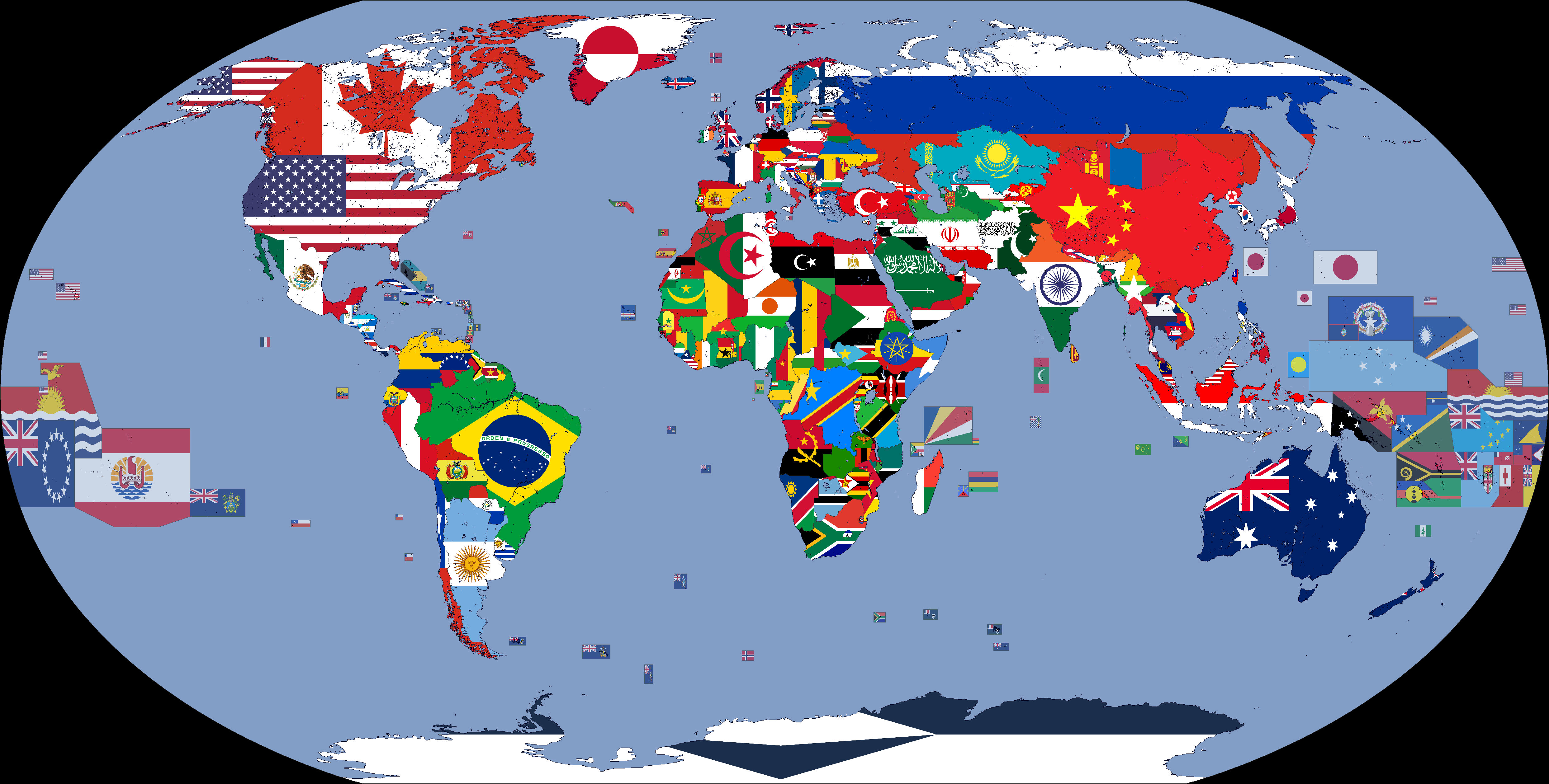
| 描述Flag Map of The World (2022).png |
English: A map showing the flags of the world in 2022. |
| 日期 | |
| 來源 | Geography and Space |
| 作者 | Cookie030307 |
| Flag maps of the world for historical use | |
|
19th Century | |
|
20th Century | |
|
1914 · 1930 · 1935 · 1937 · March 1938 · 1938 · WWII · 1962 · 1968 · 1970 · 1972 · 1974 · 1985 · 1986 · 1988 · 1989 · 1990 · 1991 · 1992 · 1993 · 1994 · 2000 | |
|
21st Century | |
|
2001 · 2002 · 2003 · 2005 · 2007 · 2008 · 2009 · 2010 · 2011 · 2012 · 2013 · 2015 · 2016 · 2017 · 2018 · 2019 · 2020 · 2021 · 2022 · 2023 · 2024 | |
|
Other Versions | |
|
Flag Map of the World · Flag Map of The World (DTI) · Flag Map of The World (DT&UCI) · Flag Map of The World (DTIN) · Flag Map of The World (DT&UCIN) | |
| (this template: • view • discuss ) | |
.png)
.png)
.png)
.png)
.png)
.png)
.png)
.png)
.png)
.png)
.png)
.png)
.png)
.png)
.png)
.png)
.png)
.png)
.png)
.png)
.png)
.png)
.png)
.png)
.png)
.png)
.png)
.png)
.png)
.png)
.png)
.png)
.png)
.png)
.png)
.png)
.png)
.png)
.png)
.png)
.png)
.png)
.png)
.png)
.png)
.png)
.png)
授權條款
此檔案採用創用CC 姓名標示-相同方式分享 4.0 國際授權條款。
- 您可以自由:
- 分享 – 複製、發佈和傳播本作品
- 重新修改 – 創作演繹作品
- 惟需遵照下列條件:
- 姓名標示 – 您必須指名出正確的製作者,和提供授權條款的連結,以及表示是否有對內容上做出變更。您可以用任何合理的方式來行動,但不得以任何方式表明授權條款是對您許可或是由您所使用。
- 相同方式分享 – 如果您利用本素材進行再混合、轉換或創作,您必須基於如同原先的相同或兼容的條款,來分布您的貢獻成品。
說明
添加單行說明來描述出檔案所代表的內容
在此檔案描寫的項目
描繪內容
沒有維基數據項目的某些值
1 2 2022
image/png
檔案歷史
點選日期/時間以檢視該時間的檔案版本。
| 日期/時間 | 縮圖 | 尺寸 | 使用者 | 備註 | |
|---|---|---|---|---|---|
| 目前 | 2024年1月7日 (日) 01:18 | | 4,974 × 2,519(851 KB) | Cookie030307 | Updated to match current flags. |
| 2023年7月17日 (一) 08:05 |  | 4,974 × 2,519(850 KB) | Cookie030307 | Made some changes. | |
| 2023年1月2日 (一) 04:11 |  | 4,974 × 2,519(854 KB) | Cookie030307 | Removed the Russian Recognized Border. | |
| 2023年1月2日 (一) 04:05 |  | 4,974 × 2,519(854 KB) | Cookie030307 | Removed the disputed territories. | |
| 2022年12月31日 (六) 12:44 |  | 4,974 × 2,519(856 KB) | Cookie030307 | Fixed some errors, Updated some maps. | |
| 2022年12月9日 (五) 23:47 |  | 4,974 × 2,519(855 KB) | Tandreasen0421 | Reverted to version as of 10:26, 12 November 2022 (UTC) | |
| 2022年12月9日 (五) 16:39 |  | 4,974 × 2,519(856 KB) | Salma3232 | Reverted to version as of 08:17, 18 June 2022 (UTC) | |
| 2022年11月12日 (六) 10:26 |  | 4,974 × 2,519(855 KB) | Рагин1987 | Kherson | |
| 2022年11月10日 (四) 19:57 |  | 4,974 × 2,519(855 KB) | Tandreasen0421 | I think this version is good because that's how the Russian invasion of Ukraine was first been added into this file. | |
| 2022年11月10日 (四) 03:49 |  | 4,974 × 2,519(855 KB) | Tandreasen0421 | The Kharkiv region is almost completely de-occupied, carefully following the latest information. Reverted back to the original edit.. |
檔案用途
下列3個頁面有用到此檔案:
詮釋資料
此檔案中包含其他資訊,這些資訊可能是由數位相機或掃描器在建立或數位化過程中所新增的。若檔案自原始狀態已被修改,一些詳細資料可能無法完整反映出已修改的檔案。
| 水平解析度 | 37.75 dpc |
|---|---|
| 垂直解析度 | 37.75 dpc |
.png)