File:National-atlas-blank-state-outlines.png
From Wikipedia, the free encyclopedia
冇更高解像度嘅圖像。
National-atlas-blank-state-outlines.png (725 × 491 像素,檔案大細:34 KB ,MIME類型:image/png)

|
This map image could be recreated using vector graphics as an SVG file. This has several advantages; see Commons:Media for cleanup for more information. If an SVG form of this image is already available, please upload it. After uploading an SVG, replace this template with {{vector version available|new image name.svg}}.
|
摘要
| 描述National-atlas-blank-state-outlines.png |
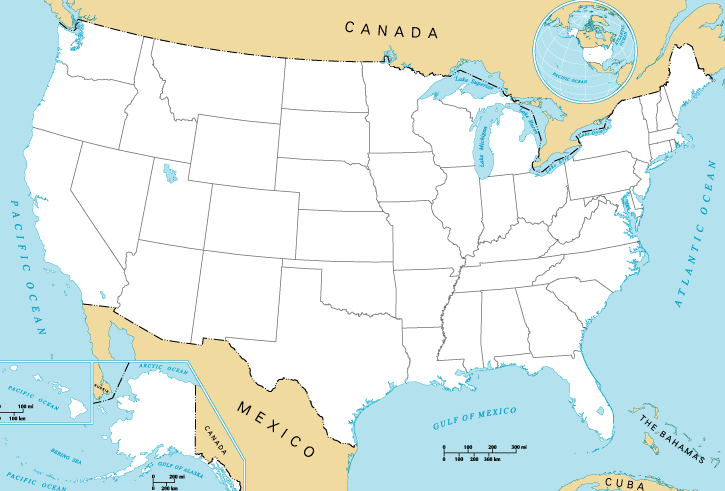
English: Map of the United States of America. |
| 來源 | National Atlas of the United States. |
| 作者 | National Atlas of the United States. |
| Other versions | Derivative works of this file: 13-colonies-present-boundaries.png |
協議
| Public domainPublic domainfalsefalse |
This map was obtained from an edition of the National Atlas of the United States. Like almost all works of the U.S. federal government, works from the National Atlas are in the public domain in the United States.
Online access: NationalAtlas.gov | 1970 print edition: Library of Congress, Perry-Castañeda Library čeština | Deutsch | English | français | Bahasa Indonesia | italiano | македонски | മലയാളം | sicilianu | 中文 | 中文(简体) | 中文(繁體) | +/− |
Original upload log
The original description page was here. All following user names refer to en.wikipedia.
- 2004-10-13 21:41 Jengod 758×584× (119202 bytes) {{PD-USGov}}
Captions
Add a one-line explanation of what this file represents
Map of the contiguous United States
檔案歷史
撳個日期/時間去睇響嗰個時間出現過嘅檔案。
| 日期/時間 | 縮圖 | 尺寸 | 用戶 | 註解 | |
|---|---|---|---|---|---|
| 現時 | 2015年5月31號 (日) 16:27 | | 725 × 491(34 KB) | Cmdrjameson | Compressed with pngout. Reduced by 74kB (68% decrease). |
| 2013年4月20號 (六) 00:47 |  | 725 × 491(109 KB) | Jay8g | cropped | |
| 2011年1月29號 (六) 06:54 |  | 758 × 584(116 KB) | File Upload Bot (Magnus Manske) | {{BotMoveToCommons|en.wikipedia|year={{subst:CURRENTYEAR}}|month={{subst:CURRENTMONTHNAME}}|day={{subst:CURRENTDAY}}}} {{Information |Description={{en|en:Category:United States maps}} |Source=Transferred from [http://en.wikipedia.org en.wikipedia]; |
檔案用途
以下嘅1版用到呢個檔:
全域檔案使用情況
下面嘅維基都用緊呢個檔案:
- ar.wikipedia.org嘅使用情況
- bg.wikipedia.org嘅使用情況
- da.wikipedia.org嘅使用情況
- de.wikipedia.org嘅使用情況
- en.wikipedia.org嘅使用情況
- fa.wikipedia.org嘅使用情況
- fo.wikipedia.org嘅使用情況
- fy.wikipedia.org嘅使用情況
- id.wikipedia.org嘅使用情況
- ko.wikipedia.org嘅使用情況
- lv.wikipedia.org嘅使用情況
- ms.wikipedia.org嘅使用情況
- my.wikipedia.org嘅使用情況
- no.wikipedia.org嘅使用情況
- pl.wikipedia.org嘅使用情況
- ro.wikipedia.org嘅使用情況
- sco.wikipedia.org嘅使用情況
- simple.wikipedia.org嘅使用情況
- sl.wikipedia.org嘅使用情況
- sv.wikipedia.org嘅使用情況
- ta.wikipedia.org嘅使用情況
- ur.wikipedia.org嘅使用情況
- vi.wikipedia.org嘅使用情況
Metadata
呢個檔案有額外嘅資料。佢應該係數碼相機或者掃描器整出來嘅。如果佢整咗之後畀人改過,裏面嘅資料未必同改過之後相符。
| 橫解像度 | 37.8 dpc |
|---|---|
| 直解像度 | 37.8 dpc |