Gompitz/Altfranken
Statistischer Stadtteil von Dresden Aus Wikipedia, der freien Enzyklopädie
Statistischer Stadtteil von Dresden Aus Wikipedia, der freien Enzyklopädie
Gompitz/Altfranken mit Ockerwitz, Pennrich, Roitzsch, Steinbach, Unkersdorf und Zöllmen ist ein statistischer Stadtteil von Dresden. Der lange Stadtteilname resultiert aus der Aneinanderreihung von insgesamt acht recht einwohnerarmen Ortsteilen der beiden Ortschaften Gompitz und Altfranken, die in dieser Einheit statistisch erfasst werden.
 mit Ockerwitz, Pennrich, Roitzsch, Steinbach, Unkersdorf und Zöllmen  mit Ockerwitz, Pennrich, Roitzsch, Steinbach, Unkersdorf und Zöllmen Statistischer Stadtteil Nr. 99 von Dresden | |
|---|---|
 | |
| Koordinaten | 51° 2′ 20″ N, 13° 38′ 0″ O |
| Höhe | 165–295 m ü. NN |
| Fläche | 13,01 km² |
| Einwohner | 4403 (31. Dez. 2017) |
| Bevölkerungsdichte | 338 Einwohner/km² |
| Postleitzahl | 01156 |
| Vorwahl | 0351 |
| Website | www.dresden.de |
| Gliederung | |
| Ortsteile |
Altfranken, Gompitz, Ockerwitz, Pennrich, Roitzsch, Steinbach, Unkersdorf, Zöllmen |
| Verkehrsanbindung | |
| Autobahn | |
| Bundesstraße | |
| Straßenbahn | 7 |
| Bus | 70, 90, 91, 162, 333 |
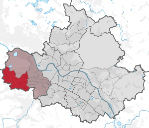
Der statistische Stadtteil Gompitz/Altfranken grenzt im Westen an die Gemeinden Klipphausen und Wilsdruff sowie im Süden an die Große Kreisstadt Freital. Im Osten wird er durch die anderen Dresdner statistischen Stadtteile Briesnitz, Gorbitz-Nord/Neuomsewitz und Gorbitz-Süd begrenzt. Nördlich benachbart liegt das ebenfalls zu Dresden gehörige Cossebaude/Mobschatz/Oberwartha.
Die Grenzen des statistischen Stadtteils werden durch die bis 1997 beziehungsweise 1999 existierende Stadtgrenze Dresdens im Osten sowie die aktuelle Stadtgrenze Dresdens im Süden und Westen gebildet. Im Norden verläuft die Grenze abschnittsweise im Zschoner Grund. Altfranken/Gompitz liegt somit im östlichen Meißner Hochland und reicht bis an den Rand des Elbtalkessels heran.
Neben Altfranken gehören zu diesem statistischen Stadtteil die Gompitzer Ortsteile Unkersdorf, Pennrich, Gompitz, Roitzsch, Steinbach, Ockerwitz und Zöllmen. Mit nur 319 Einwohnern pro km² ist Gompitz/Altfranken dünn besiedelt und weist aufgrund seines dörflich-ländlichen Charakters nach Schönfeld/Schullwitz die zweitniedrigste Bevölkerungsdichte aller statistischer Stadtteile Dresdens auf. Der Stadtteil gliedert sich in folgende acht statistische Bezirke:
Der statistische Stadtteil wird von der A17 und der B173 durchquert, die sich an der hier befindlichen Anschlussstelle Dresden-Gorbitz kreuzen. Am Nordrand von Gompitz/Altfranken liegt das Autobahndreieck Dresden-West, an dem Anschluss an die A4 besteht. Die einzelnen Ortsteile werden untereinander außerdem durch mehrere Kreisstraßen verbunden.
Gompitz/Altfranken weist insgesamt 24 Bushaltestellen auf. Neben den Buslinien der Dresdner Verkehrsbetriebe wird der statistische Stadtteil auch von mehreren Linien des Regionalverkehr Sächsische Schweiz-Osterzgebirge durchfahren. Im Herbst 2008 erfolgte darüber hinaus die Fertigstellung der Fortsetzung der Straßenbahnlinie 7 von Gorbitz über Gompitz nach Pennrich. Gompitz/Altfranken ist somit insgesamt gut an den ÖPNV angeschlossen.
Seamless Wikipedia browsing. On steroids.
Every time you click a link to Wikipedia, Wiktionary or Wikiquote in your browser's search results, it will show the modern Wikiwand interface.
Wikiwand extension is a five stars, simple, with minimum permission required to keep your browsing private, safe and transparent.
