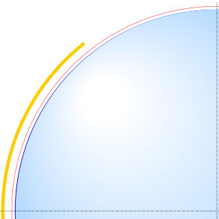
Earth ellipsoid
Geometric figure which approximates the Earth's shape / From Wikipedia, the free encyclopedia
Dear Wikiwand AI, let's keep it short by simply answering these key questions:
Can you list the top facts and stats about Earth ellipsoid?
Summarize this article for a 10 year old
An Earth ellipsoid or Earth spheroid is a mathematical figure approximating the Earth's form, used as a reference frame for computations in geodesy, astronomy, and the geosciences. Various different ellipsoids have been used as approximations.
This article needs additional citations for verification. (October 2016) |

It is a spheroid (an ellipsoid of revolution) whose minor axis (shorter diameter), which connects the geographical North Pole and South Pole, is approximately aligned with the Earth's axis of rotation. The ellipsoid is defined by the equatorial axis (a) and the polar axis (b); their radial difference is slightly more than 21 km, or 0.335% of a (which is not quite 6,400 km).
Many methods exist for determination of the axes of an Earth ellipsoid, ranging from meridian arcs up to modern satellite geodesy or the analysis and interconnection of continental geodetic networks. Amongst the different set of data used in national surveys are several of special importance: the Bessel ellipsoid of 1841, the international Hayford ellipsoid of 1924, and (for GPS positioning) the WGS84 ellipsoid.