File:Calgary_street_map.png
From Wikipedia, the free encyclopedia
Size of this preview: 483 × 600 pixels. Other resolutions: 193 × 240 pixels | 386 × 480 pixels | 960 × 1,192 pixels.
Original file (960 × 1,192 pixels, file size: 802 KB, MIME type: image/png)
| This is a file from the Wikimedia Commons. Information from its description page there is shown below. Commons is a freely licensed media file repository. You can help. |
Summary
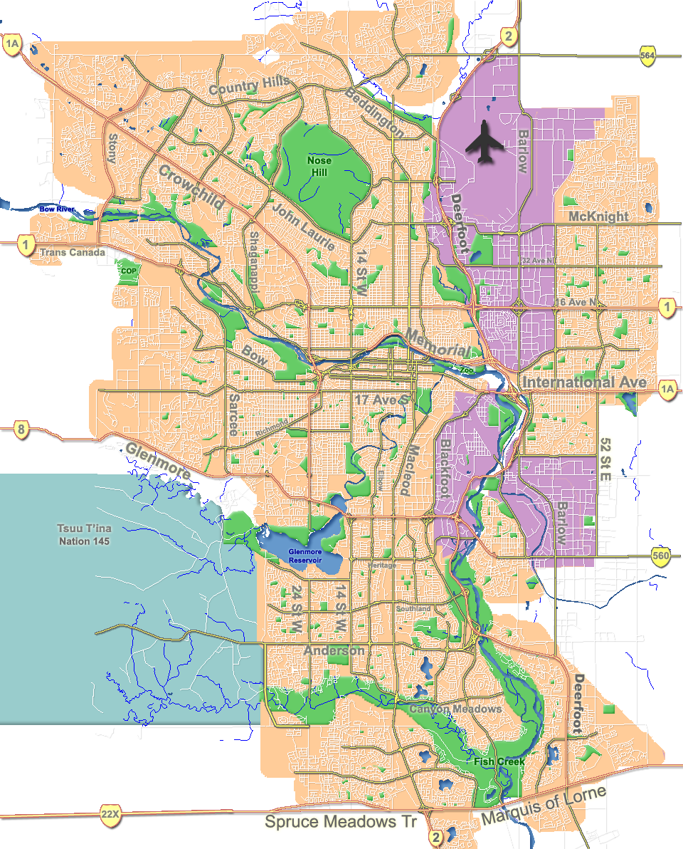
| DescriptionCalgary street map.png |
English: Outline map of Calgary. |
| Date | |
| Source | GIS data |
| Author | Qyd |
| Other versions |
Derivative works of this file: |
| Camera location | 51° 02′ 42″ N, 114° 03′ 26″ W | View this and other nearby images on: OpenStreetMap |
|---|
Licensing
| Public domainPublic domainfalsefalse |
| I, the copyright holder of this work, release this work into the public domain. This applies worldwide. In some countries this may not be legally possible; if so: I grant anyone the right to use this work for any purpose, without any conditions, unless such conditions are required by law. |
Captions
Add a one-line explanation of what this file represents
Items portrayed in this file
depicts
August 2006
51°2'42.000"N, 114°3'25.999"W
image/png
08857a5adfd6f876a50c151f2829721cbe293ea0
820,949 byte
1,192 pixel
960 pixel
File history
Click on a date/time to view the file as it appeared at that time.
| Date/Time | Thumbnail | Dimensions | User | Comment | |
|---|---|---|---|---|---|
| current | 18:31, 7 October 2007 | | 960 × 1,192 (802 KB) | Qyd | fix highway name |
| 19:44, 18 April 2007 |  | 960 × 1,192 (791 KB) | Qyd | spelling | |
| 17:28, 18 September 2006 |  | 960 × 1,192 (792 KB) | Qyd | outline industrial areas | |
| 17:20, 16 August 2006 |  | 960 × 1,192 (802 KB) | Qyd | added airport symbol and highway shields | |
| 15:21, 14 August 2006 |  | 960 × 1,192 (797 KB) | Qyd | fixed interchanges | |
| 04:46, 14 August 2006 |  | 960 × 1,192 (700 KB) | Qyd | added city parks | |
| 04:19, 14 August 2006 |  | 960 × 1,192 (645 KB) | Qyd | highways names added | |
| 00:17, 14 August 2006 |  | 960 × 1,192 (491 KB) | Qyd | {{Information |Description= Outline map of Calgary |Source=GIS data |Date=Aug 2006 |Author=Qyd |Permission=All |other_versions=Image:CalgaryAB-map.png }} Category:Calgary Category:Maps of cities in Canada |
File usage
More than 100 pages use this file. The following list shows the first 100 pages that use this file only. A full list is available.
- Abbeydale, Calgary
- Acadia, Calgary
- Albert Park/Radisson Heights
- Alberta Children's Hospital
- Alberta University of the Arts
- Altadore, Calgary
- Applewood Park, Calgary
- Arbour Lake, Calgary
- Aspen Woods, Calgary
- Banff Trail, Calgary
- Bankview, Calgary
- Bayview, Calgary
- Beddington Heights, Calgary
- Bel-Aire, Calgary
- Beltline, Calgary
- Bowness, Calgary
- Braeside, Calgary
- Brentwood, Calgary
- Bridgeland, Calgary
- Bridlewood, Calgary
- Cambrian Heights, Calgary
- Charleswood, Calgary
- Chinatown, Calgary
- Chinook Centre
- Citadel, Calgary
- Confederation Park, Calgary
- Copperfield, Calgary
- Crescent Heights, Calgary
- Dalhousie, Calgary
- Downtown Calgary
- Downtown West End, Calgary
- Eau Claire, Calgary
- Edgemont, Calgary
- Edworthy Park
- Evergreen, Calgary
- Fish Creek Provincial Park
- Foothills Medical Centre
- Forest Lawn, Calgary
- Glendale, Calgary
- Glenmore Reservoir
- Heritage Park Historical Village
- Hillhurst, Calgary
- Hounsfield Heights/Briar Hill
- Inglewood, Calgary
- Kensington, Calgary
- Killarney, Calgary
- Lake Bonavista, Calgary
- Lakeview, Calgary
- Lincoln Park, Calgary
- List of airports in the Calgary area
- List of neighbourhoods in Calgary
- MNP Community & Sport Centre
- MacEwan Glen
- Maple Ridge, Calgary
- Marda Loop, Calgary
- Market Mall
- McKenzie Lake, Calgary
- McKenzie Towne, Calgary
- McMahon Stadium
- Meadowlark Park, Calgary
- Midnapore, Calgary
- Mission, Calgary
- Montgomery, Calgary
- Mount Pleasant, Calgary
- Mount Royal, Calgary
- North Haven, Calgary
- Nose Hill Park
- Panorama Hills, Calgary
- Parkdale, Calgary
- Peter Lougheed Centre
- Pineridge, Calgary
- Ramsay, Calgary
- Red Carpet, Calgary
- Renfrew, Calgary
- Richmond, Calgary
- Rockyview General Hospital
- Rosedale, Calgary
- Sandstone Valley, Calgary
- Scarboro, Calgary
- Shaganappi, Calgary
- Signal Hill, Calgary
- Sikome Lake
- Somerset, Calgary
- South Calgary, Calgary
- Springbank Hill, Calgary
- Sunalta, Calgary
- Sunnyside, Calgary
- Sunridge Mall
- Telus Spark Science Centre
- The Military Museums
- Transportation in Calgary
- Tsuu T'ina 145
- University Heights, Calgary
- Valley Ridge, Calgary
- Varsity, Calgary
- West Hillhurst, Calgary
- Wildwood, Calgary
- Willow Park, Calgary
- Winston Heights-Mountview
- Woodlands, Calgary
View more links to this file.
Global file usage
The following other wikis use this file:
- Usage on ar.wikipedia.org
- Usage on ast.wikipedia.org
- Usage on bh.wikipedia.org
- Usage on bn.wikipedia.org
- Usage on cy.wikipedia.org
- Usage on da.wikipedia.org
- Usage on eo.wikipedia.org
- Kalgario
- Provinca Parko Fish Creek
- Beltline
- Akvorezervujo Glenmore
- Eau Claire
- Kalgaria Turo
- Muzeo Glenbow
- Sud-Alberta Jubilea Aŭditorio
- Parko Nose Hill
- Parko de Princa Insulo
- Bowness
- Parko Edworthy
- Konfederacia Parko (Kalgario)
- Inglewood (Kalgario)
- Acadia
- Olimpika Ovalo
- Internacia Flughaveno Kalgario
- Ŝablono:Geokesto lokumilo Kalgario
- Ŝablono:Situo sur mapo Kanado Kalgario
- Usage on es.wikipedia.org
- Usage on fa.wikipedia.org
- Usage on fi.wikipedia.org
- Usage on fo.wikipedia.org
- Usage on fr.wikipedia.org
- Usage on fr.wikivoyage.org
- Usage on fy.wikipedia.org
- Usage on hi.wikipedia.org
- Usage on id.wikipedia.org
View more global usage of this file.
Metadata
This file contains additional information, probably added from the digital camera or scanner used to create or digitize it.
If the file has been modified from its original state, some details may not fully reflect the modified file.
| Horizontal resolution | 28.35 dpc |
|---|---|
| Vertical resolution | 28.35 dpc |
Retrieved from "https://en.wikipedia.org/wiki/File:Calgary_street_map.png"