File:China_topography_full_res.jpg
From Wikipedia, the free encyclopedia
Size of this preview: 800 × 459 pixels. Other resolutions: 320 × 184 pixels | 640 × 368 pixels | 1,024 × 588 pixels | 1,280 × 735 pixels | 2,560 × 1,470 pixels | 6,302 × 3,619 pixels.
Original file (6,302 × 3,619 pixels, file size: 4.72 MB, MIME type: image/jpeg)
| This is a file from the Wikimedia Commons. Information from its description page there is shown below. Commons is a freely licensed media file repository. You can help. |
Summary
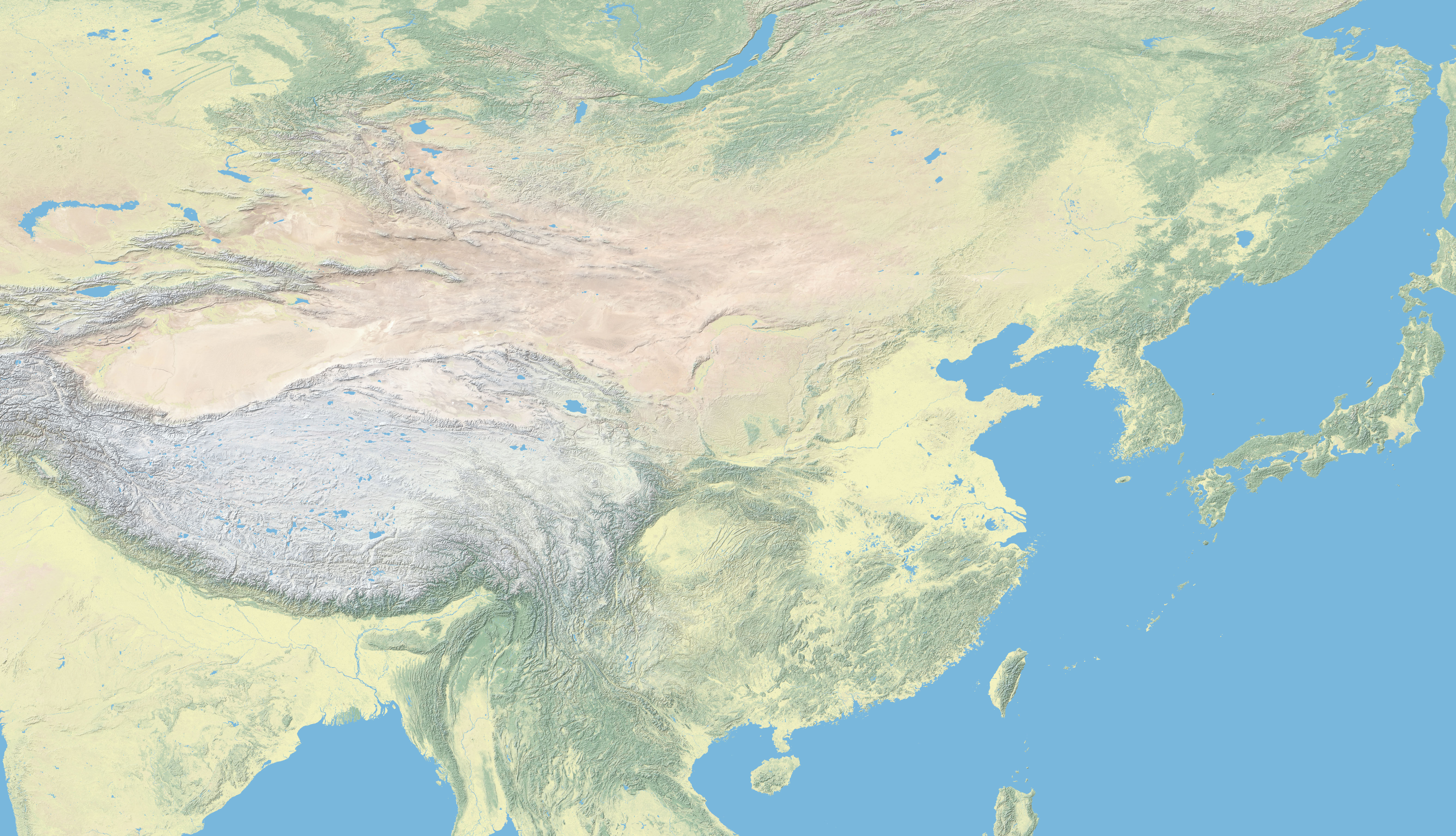
| DescriptionChina topography full res.jpg | topographic map of china |
| Date | |
| Source | Tom Patterson, US National Park Service Natural Earth |
| Author | uploaded by Fremantleboy 7 Aug. 2007 |

|
This map has been made or improved in the German Kartenwerkstatt (Map Lab). You can propose maps to improve as well.
azərbaycanca ∙ čeština ∙ Deutsch ∙ Deutsch (Sie-Form) ∙ English ∙ español ∙ français ∙ italiano ∙ latviešu ∙ magyar ∙ Nederlands ∙ Plattdüütsch ∙ polski ∙ português ∙ română ∙ sicilianu ∙ slovenščina ∙ suomi ∙ македонски ∙ русский ∙ ქართული ∙ հայերեն ∙ বাংলা ∙ ไทย ∙ +/−
|
Licensing
| Public domainPublic domainfalsefalse |
This work is in the public domain in the United States because it is a work prepared by an officer or employee of the United States Government as part of that person’s official duties under the terms of Title 17, Chapter 1, Section 105 of the US Code.
Note: This only applies to original works of the Federal Government and not to the work of any individual U.S. state, territory, commonwealth, county, municipality, or any other subdivision. This template also does not apply to postage stamp designs published by the United States Postal Service since 1978. (See § 313.6(C)(1) of Compendium of U.S. Copyright Office Practices). It also does not apply to certain US coins; see The US Mint Terms of Use.
|
 | |
| This file has been identified as being free of known restrictions under copyright law, including all related and neighboring rights. | ||
https://creativecommons.org/publicdomain/mark/1.0/PDMCreative Commons Public Domain Mark 1.0falsefalse
Captions
Add a one-line explanation of what this file represents
Items portrayed in this file
depicts
17 June 2007
image/jpeg
df3e5e1e1208ba508a3de04fa9a726bad9ae9438
4,949,057 byte
3,619 pixel
6,302 pixel
File history
Click on a date/time to view the file as it appeared at that time.
| Date/Time | Thumbnail | Dimensions | User | Comment | |
|---|---|---|---|---|---|
| current | 14:54, 7 August 2007 | | 6,302 × 3,619 (4.72 MB) | Fremantleboy | == Beschreibung == {{Information |Description=topographic map of china |Source=Tom Patterson, US National Park Service [http://www.carto.net/patterson/full/LC_SR_W_16200_E.zip Natural Earth] |Date=17.06.2007 |Author= uploaded by [[User:Fremantleboy|Freman |
File usage
The following pages on the English Wikipedia use this file (pages on other projects are not listed):
Global file usage
The following other wikis use this file:
- Usage on ar.wikipedia.org
- Usage on de.wikipedia.org
- Usage on it.wikipedia.org
- Usage on ja.wikipedia.org
- Usage on kn.wikipedia.org
- Usage on sl.wikipedia.org
- Usage on zh.wikipedia.org
Metadata
This file contains additional information, probably added from the digital camera or scanner used to create or digitize it.
If the file has been modified from its original state, some details may not fully reflect the modified file.
| Width | 16,200 px |
|---|---|
| Height | 16,200 px |
| Compression scheme | Uncompressed |
| Pixel composition | RGB |
| Orientation | Normal |
| Number of components | 3 |
| Horizontal resolution | 72 dpi |
| Vertical resolution | 72 dpi |
| Data arrangement | chunky format |
| Software used | Adobe Photoshop CS2 Windows |
| File change date and time | 16:49, 7 August 2007 |
| Color space | Uncalibrated |
Retrieved from "https://en.wikipedia.org/wiki/File:China_topography_full_res.jpg"