File:Declaration_of_Panama_map.png
From Wikipedia, the free encyclopedia
Size of this preview: 556 × 600 pixels. Other resolutions: 222 × 240 pixels | 445 × 480 pixels | 712 × 768 pixels | 949 × 1,024 pixels | 1,674 × 1,806 pixels.
Original file (1,674 × 1,806 pixels, file size: 835 KB, MIME type: image/png)
| This is a file from the Wikimedia Commons. Information from its description page there is shown below. Commons is a freely licensed media file repository. You can help. |
Summary
| DescriptionDeclaration of Panama map.png |
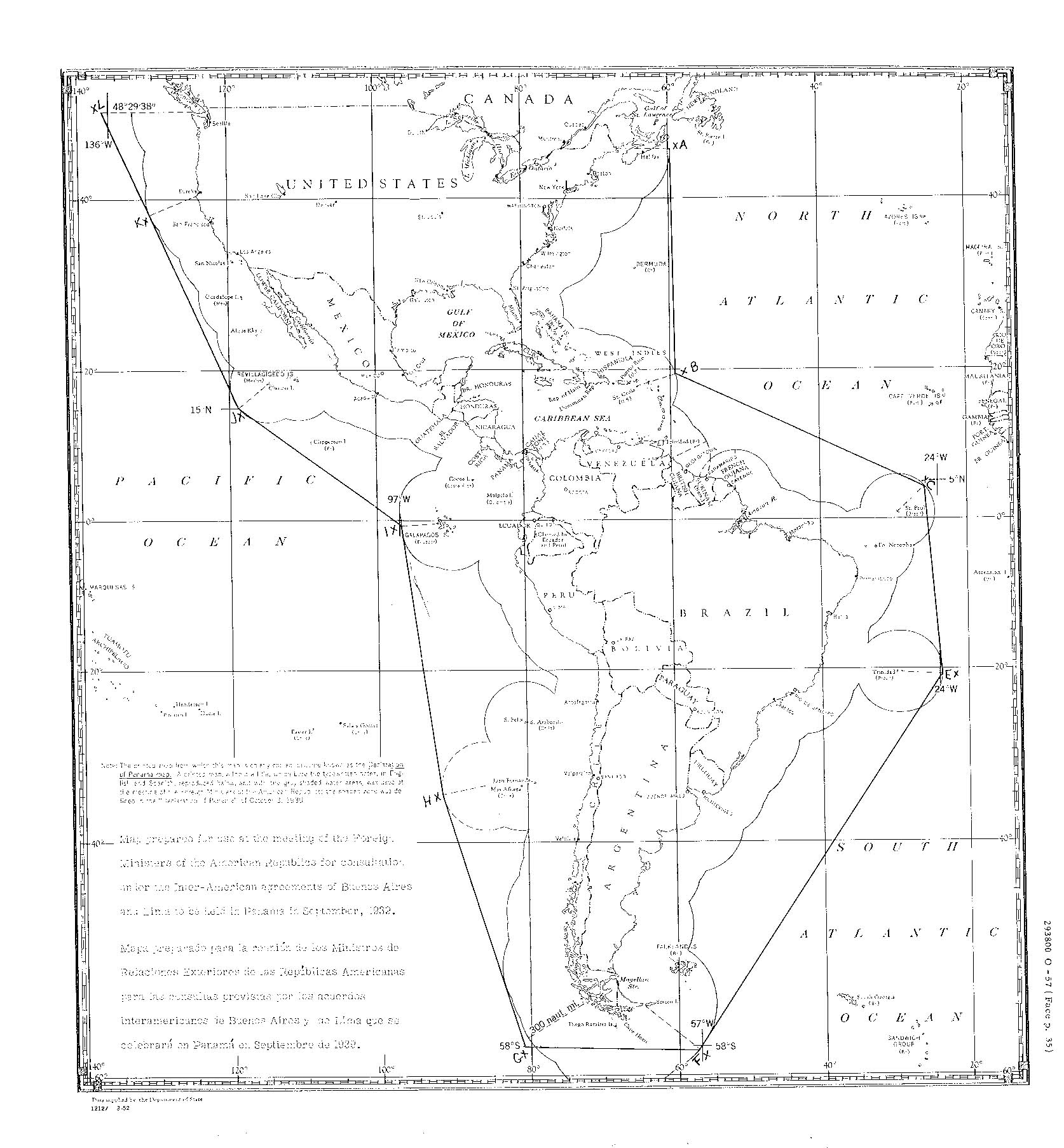
English: A draft map used as the basis of the Declaration of Panama, 1939. The hand drawn straight lines between the marks "x" labelled "A" to "L" (missing "D") were personally drawn by President Roosevelt. The points are on arcs prepared by a draftsman 300 nautical miles from the coast, so the area defined mostly exceeds 300 nautical miles offshore. These points were used as the basis of the textual description defining the area in the Declaration of Panama.[1] Deutsch: Entwurfsskizze der panamerikanischen Sicherheitszone (Panamaerklärung 1939) |
| Date | |
| Source | http://images.library.wisc.edu/FRUS/EFacs/1939v05/reference/frus.frus1939v05.i0004.pdf#page=21 |
| Author | U.S. Department of State |
Licensing
| Public domainPublic domainfalsefalse |
This work is in the public domain in the United States because it is a work prepared by an officer or employee of the United States Government as part of that person’s official duties under the terms of Title 17, Chapter 1, Section 105 of the US Code.
Note: This only applies to original works of the Federal Government and not to the work of any individual U.S. state, territory, commonwealth, county, municipality, or any other subdivision. This template also does not apply to postage stamp designs published by the United States Postal Service since 1978. (See § 313.6(C)(1) of Compendium of U.S. Copyright Office Practices). It also does not apply to certain US coins; see The US Mint Terms of Use.
|
 | |
| This file has been identified as being free of known restrictions under copyright law, including all related and neighboring rights. | ||
https://creativecommons.org/publicdomain/mark/1.0/PDMCreative Commons Public Domain Mark 1.0falsefalse
Captions
Add a one-line explanation of what this file represents
Neutrale panamerikanische Sicherheitszone gemäß der Panama-Erklärung von 1939
Items portrayed in this file
depicts
September 1939
File history
Click on a date/time to view the file as it appeared at that time.
| Date/Time | Thumbnail | Dimensions | User | Comment | |
|---|---|---|---|---|---|
| current | 12:20, 20 November 2018 | | 1,674 × 1,806 (835 KB) | Rwendland | User created page with UploadWizard |
File usage
The following pages on the English Wikipedia use this file (pages on other projects are not listed):
Global file usage
The following other wikis use this file:
- Usage on de.wikipedia.org
- Usage on es.wikipedia.org
- Usage on eu.wikipedia.org
- Usage on fi.wikipedia.org
- Usage on fr.wikipedia.org
- Usage on it.wikipedia.org
- Usage on uk.wikipedia.org
- Usage on zh.wikipedia.org
Metadata
This file contains additional information, probably added from the digital camera or scanner used to create or digitize it.
If the file has been modified from its original state, some details may not fully reflect the modified file.
| Horizontal resolution | 37.79 dpc |
|---|---|
| Vertical resolution | 37.79 dpc |
Retrieved from "https://en.wikipedia.org/wiki/File:Declaration_of_Panama_map.png"