File:Tateyama_Kurobe_Alpine_Route,_Map_(Japanese).jpg
From Wikipedia, the free encyclopedia
Size of this preview: 800 × 400 pixels. Other resolutions: 320 × 160 pixels | 640 × 320 pixels | 1,024 × 512 pixels | 1,280 × 640 pixels | 2,560 × 1,280 pixels | 4,989 × 2,494 pixels.
Original file (4,989 × 2,494 pixels, file size: 7.38 MB, MIME type: image/jpeg)
| This is a file from the Wikimedia Commons. Information from its description page there is shown below. Commons is a freely licensed media file repository. You can help. |
Summary
| DescriptionTateyama Kurobe Alpine Route, Map (Japanese).jpg | |
| Date | |
| Source |
Topographic data: NASA's SRTM-1 30m Mesh (ver.3 2014) |
| Author | Batholith |
| Other versions |
|
.jpg)
.jpg)
.jpg)
| Object location | 36° 34′ 00″ N, 137° 38′ 00″ E | View this and other nearby images on: OpenStreetMap |
|---|
Licensing
| Public domainPublic domainfalsefalse |
| I, the copyright holder of this work, release this work into the public domain. This applies worldwide. In some countries this may not be legally possible; if so: I grant anyone the right to use this work for any purpose, without any conditions, unless such conditions are required by law. |
| Public domainPublic domainfalsefalse |
This image uses high-resolution digital topography data from NASA's Shuttle Radar Topography Mission (SRTM) at JPL-Caltech [1]. It is in the public domain in the United States.
|
 | |
| English | Bahasa Indonesia | македонски | polski | português | 中文 | 中文(简体) | +/− |
Captions
Add a one-line explanation of what this file represents
Items portrayed in this file
depicts
5 March 2016
36°34'0.001"N, 137°37'59.999"E
image/jpeg
File history
Click on a date/time to view the file as it appeared at that time.
| Date/Time | Thumbnail | Dimensions | User | Comment | |
|---|---|---|---|---|---|
| current | 12:13, 5 March 2016 | | 4,989 × 2,494 (7.38 MB) | Batholith | 文字位置、解像度 |
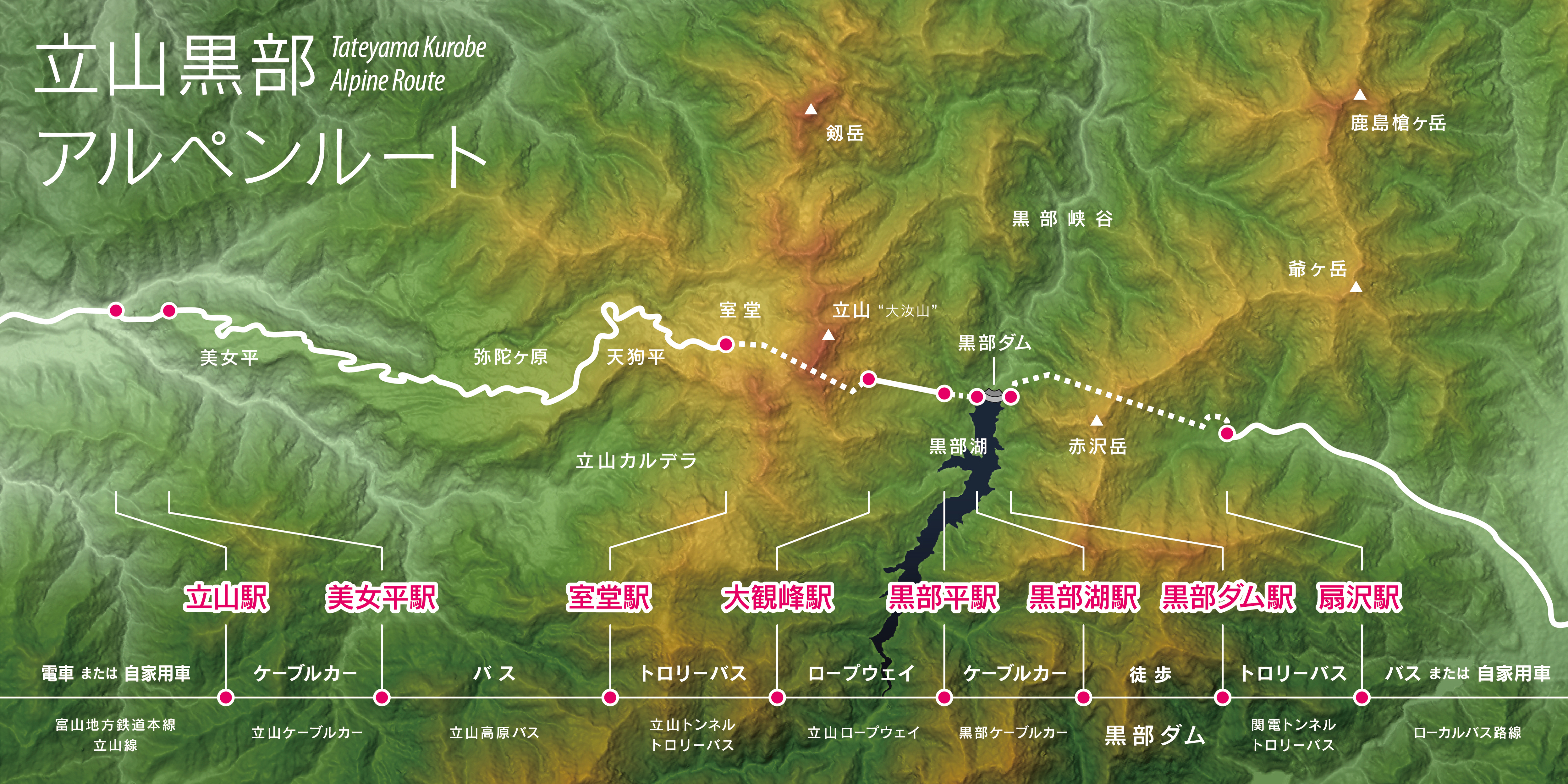
| 12:05, 5 March 2016 |  | 3,200 × 1,600 (3.43 MB) | Batholith | {{Information |Description= {{en|Map of Tateyama Kurobe Alpine Route, Chūbu region, Honshu, Japan. Data from "SRTM-1 (30m Mesh) Ver.3 2... |
File usage
The following pages on the English Wikipedia use this file (pages on other projects are not listed):
Global file usage
The following other wikis use this file:
- Usage on ja.wikipedia.org
Metadata
This file contains additional information, probably added from the digital camera or scanner used to create or digitize it.
If the file has been modified from its original state, some details may not fully reflect the modified file.
| Color space | Uncalibrated |
|---|
.jpg)