Loading AI tools

Commune in Normandy, France From Wikipedia, the free encyclopedia
Fleuré (French pronunciation: [flœʁe] ) is a commune in the Orne department in north-western France.
Fleuré | |
|---|---|
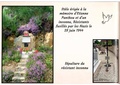
 The chateau in Fleuré | |
Location of Fleuré  | |
 Fleuré  Fleuré | |
| Coordinates: 48°41′29″N 0°03′20″W | |
| Country | France |
| Region | Normandy |
| Department | Orne |
| Arrondissement | Argentan |
| Canton | Magny-le-Désert |
| Intercommunality | Argentan Intercom |
| Government | |
| • Mayor (2020–2026) | Thierry Clérembaux[1] |
| Area 1 | 11.8 km2 (4.6 sq mi) |
| Population (2021)[2] | 202 |
| • Density | 17/km2 (44/sq mi) |
| Time zone | UTC+01:00 (CET) |
| • Summer (DST) | UTC+02:00 (CEST) |
| INSEE/Postal code | 61170 /61200 |
| Elevation | 156–265 m (512–869 ft) (avg. 164 m or 538 ft) |
| 1 French Land Register data, which excludes lakes, ponds, glaciers > 1 km2 (0.386 sq mi or 247 acres) and river estuaries. | |
The commune is made up of the following collection of villages and hamlets, Fleuriel and Fleuré.[3]
It is 1,180 hectares (4.6 sq mi) in size. The highest point in the commune is 165 metres (541 ft).
Fleuré along with another 69 communes shares part of a 20,593 hectare, Natura 2000 conservation area, called the Haute vallée de l'Orne et affluents.[4]In addition the commune along with another eight communes shares part of a 1,630 hectare, Natura 2000 conservation area, called Sites d'Ecouves.[5]
The Etangs stream, Marais de Fleuriel stream and the Bel Usse stream flow through the commune.

Seamless Wikipedia browsing. On steroids.
Every time you click a link to Wikipedia, Wiktionary or Wikiquote in your browser's search results, it will show the modern Wikiwand interface.
Wikiwand extension is a five stars, simple, with minimum permission required to keep your browsing private, safe and transparent.