Loading AI tools
Nabih Saleh (Arabic: النبيه صالح) is an island of Bahrain in the Arabian Gulf. It lies in the Tubli Bay, east of Bahrain Island, and is 2.5 km (1.6 mi) south of the capital, Manama, on Bahrain Island.
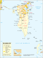
 Nabih Saleh Island Location of Nabih Saleh Island in Bahrain | |
| Geography | |
| Location | Arabian Gulf |
| Coordinates | 26.183°N 50.585°E |
| Archipelago | Bahrain |
| Adjacent to | Arabian Gulf |
| Total islands | 1 |
| Major islands |
|
| Area | 1.4 km2 (0.54 sq mi) |
| Length | 1.4 km (0.87 mi) |
| Width | 1.2 km (0.75 mi) |
| Coastline | 9 km (5.6 mi) |
| Highest elevation | 3.5 m (11.5 ft) |
| Highest point | Nabih Saleh graveyard |
| Administration | |
| Governorate | Capital Governorate |
| Largest settlement | Nabih Saleh (pop. 3,150) |
| Demographics | |
| Demonym | Bahraini |
| Population | 3,200 (2019) |
| Pop. density | 2,300/km2 (6000/sq mi) |
| Ethnic groups | Bahraini, non-Bahraini |
| Additional information | |
| Time zone | |
| ISO code | BH-14 |
The island is named for the formerly separate islands of Nebbi and Saleh.[1] The island was named after the Shi'ite holy man, Salih,[2] who received the title "Nabih Saleh" due to his asceticism and was buried on the island, where his tomb, the Shrine of Nabih Saleh, still stands.[3]
This island originally, like Sitra, was covered with farms and date palm groves, but now it has been denuded by mass deforestation.[2][4] In 2016 renovation works began on the island [5][6]
There are three neighborhoods located on the Island: 1. Kaflan 2. Quryah 3. Juzayyirah (occupied by Bahrain Defence Force as officers club)
The island belongs to the Capital Governorate of Bahrain.
It is connected to both Bahrain Island and Sitra through the Sitra Causeway.
 Map 1
Map 1 District Map


Wikiwand in your browser!
Seamless Wikipedia browsing. On steroids.
Every time you click a link to Wikipedia, Wiktionary or Wikiquote in your browser's search results, it will show the modern Wikiwand interface.
Wikiwand extension is a five stars, simple, with minimum permission required to keep your browsing private, safe and transparent.